


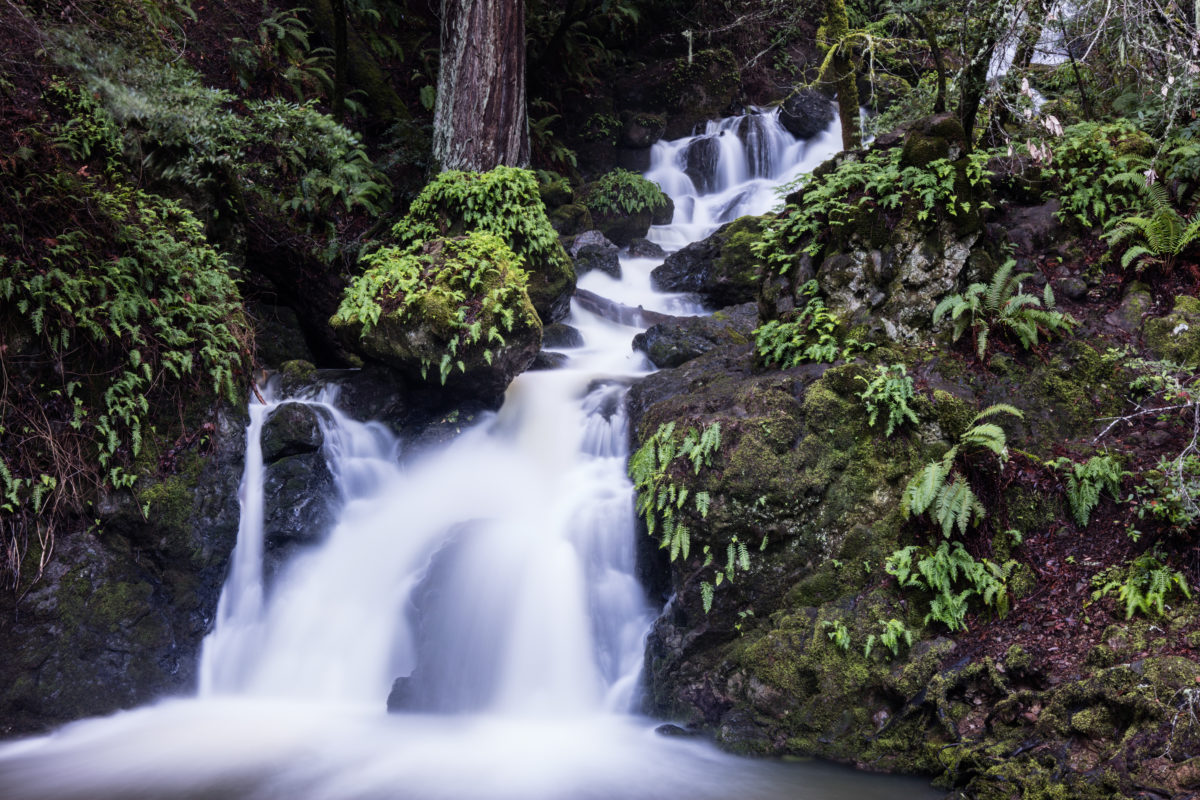
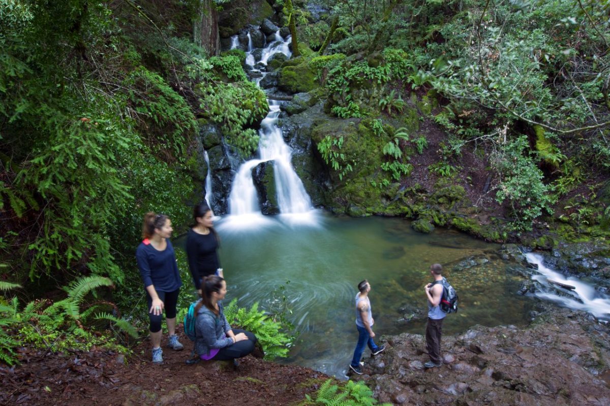
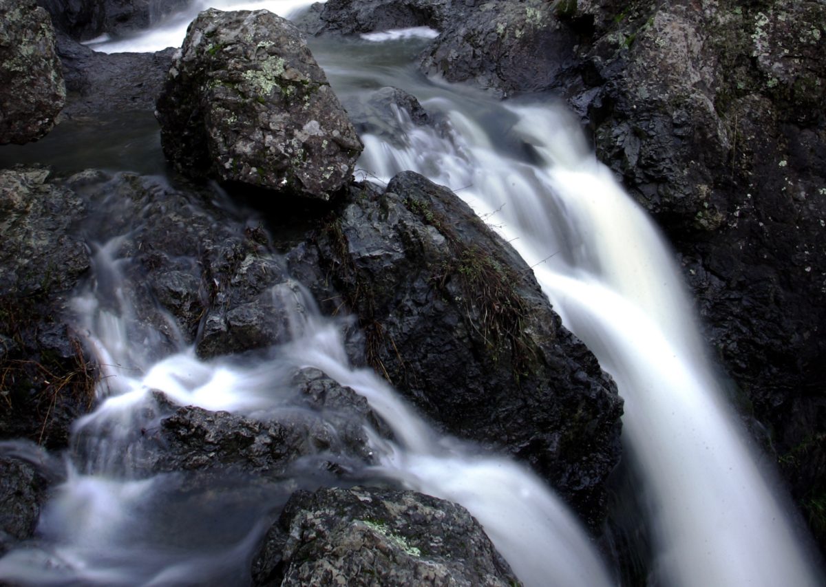


With its abundance of public parkland and open space, the North Coast is too full of gushing streams and cascading creek flows to mention them all. We’ve listed a few of our favorite waterfall spots in Sonoma, Marin and Mendocino counties to enjoy the best of the rainy season.
Trails are subject to close for maintenance or protection of the area’s flora and fauna. Be sure to check with park staff regarding current conditions and possible closures. Use caution around wet, slippery rocks as well as when hiking steep bluffs and other areas prone to erosion.
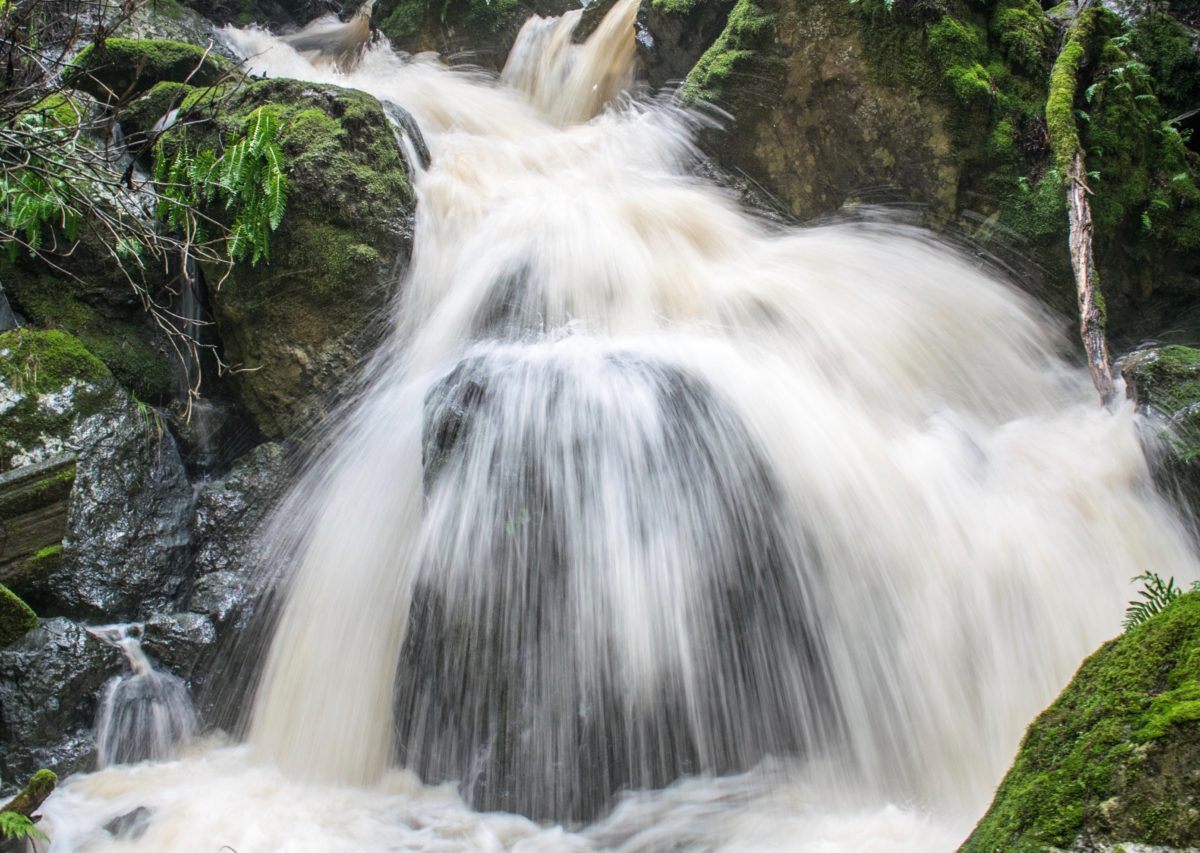
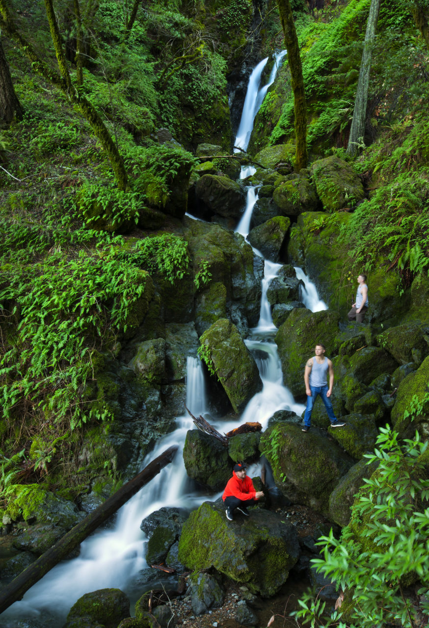
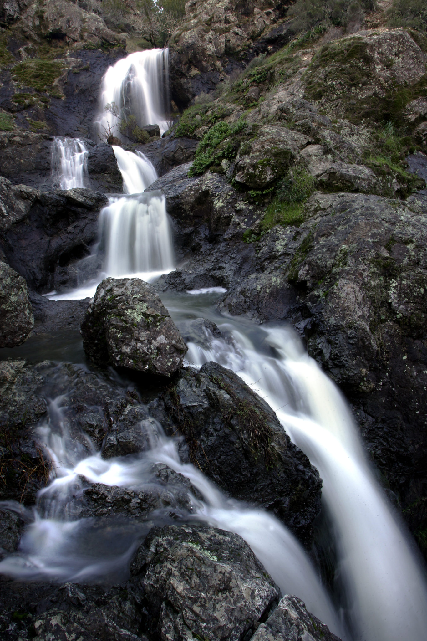
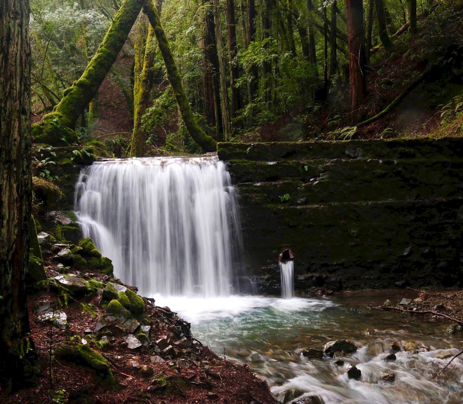
Sonoma Creek Falls, Sugarloaf Ridge State Park, Kenwood
For an easy-access, quick fix, there’s no better choice than the sweet canyon waterfall at Sugarloaf in Kenwood that gushes forth during winter rains amid huge boulders and greenery. The 25-foot waterfall draws weekend crowds who revel in the refreshing results of a wet season.
The Sonoma Creek Falls can be reached in as little as a third of a mile via the lower Canyon Trail. It’s a mostly level path to and from the falls. More parking is available up top, near the park visitor center, where the upper Canyon Trail offers a 450-foot drop down to the falls. The walk is just under a half-mile in each direction, though the return trip is a fairly steep climb up.
Those who prefer a longer trip through the redwood canyon on their way to Sonoma Creek Falls can take a 2-mile loop that starts down the Pony Gate Trail for a little over a mile before it links up with the Canyon Trail and aligns with Sonoma Creek, taking visitors up into a rocky canyon from which the waterfall springs. The hike takes about an hour.
Sugarloaf Ridge State Park, 2605 Adobe Canyon Road, Kenwood, 707-833-5712, sugarloafpark.org

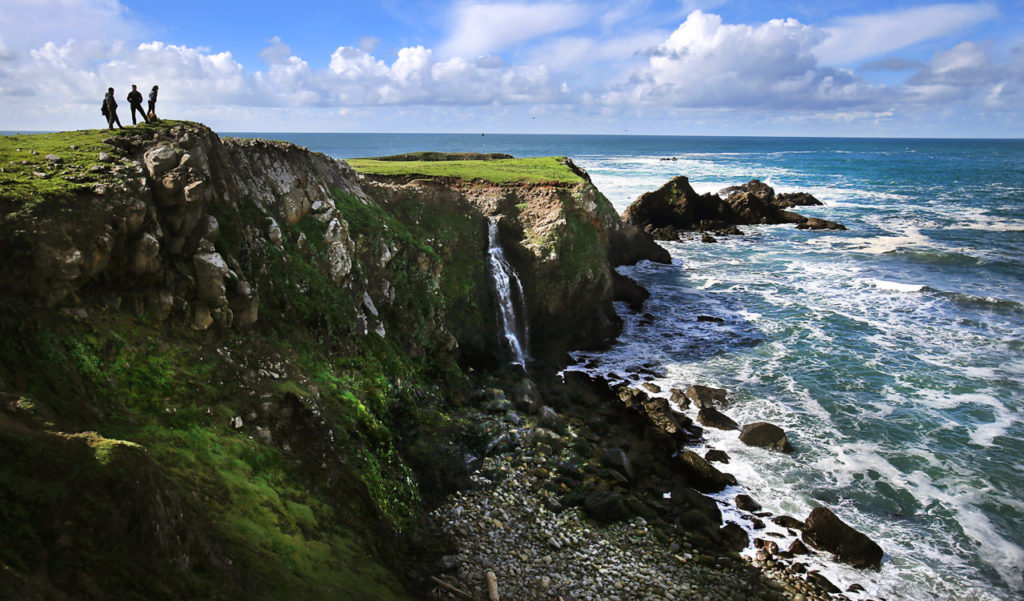
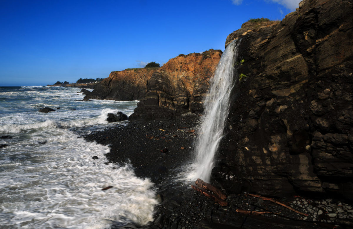
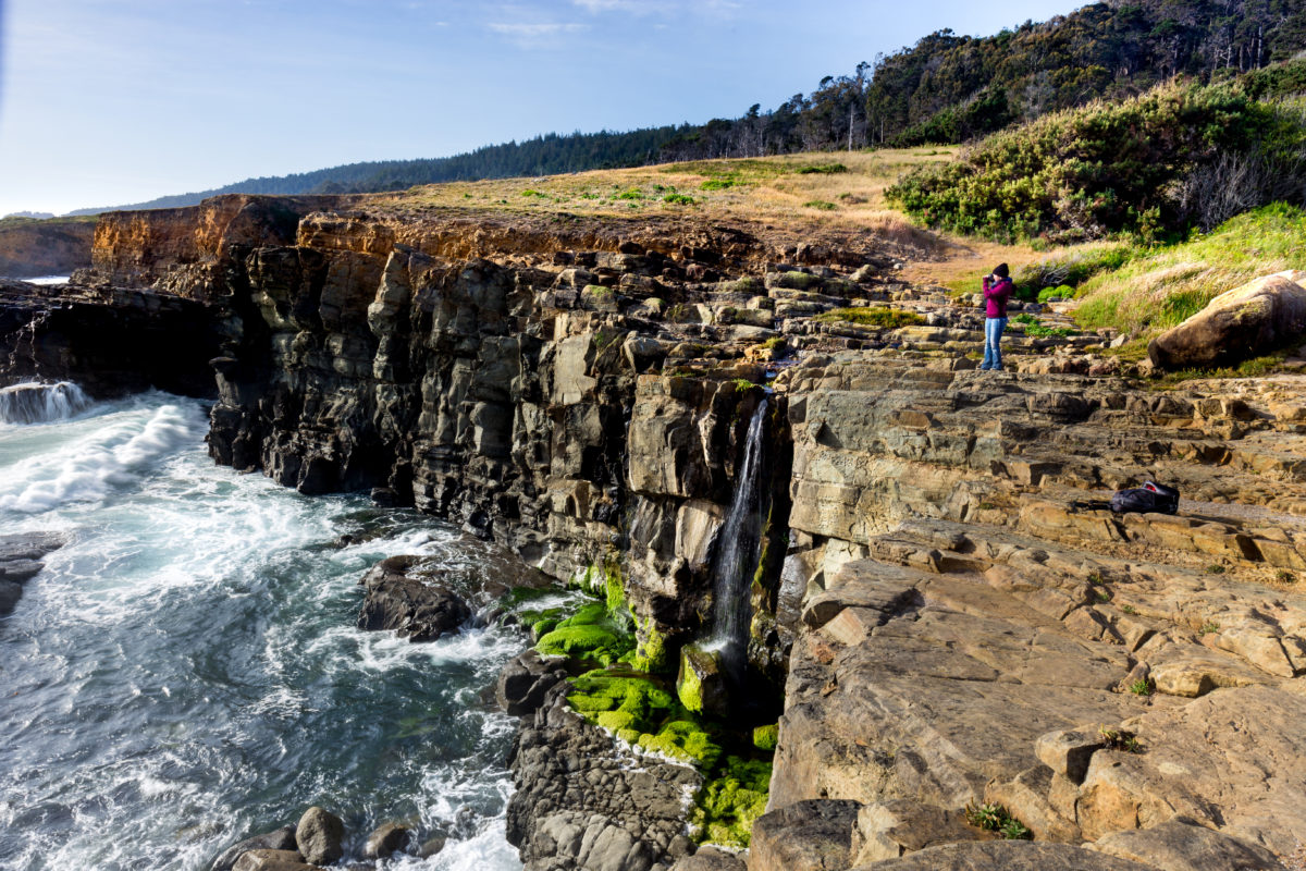
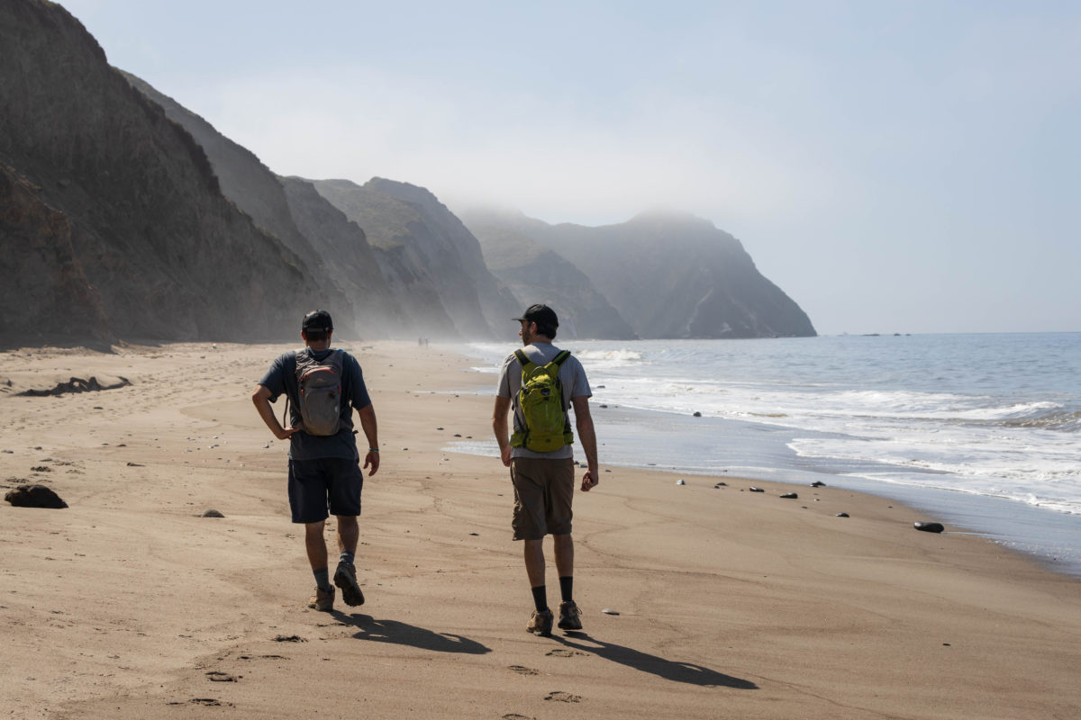
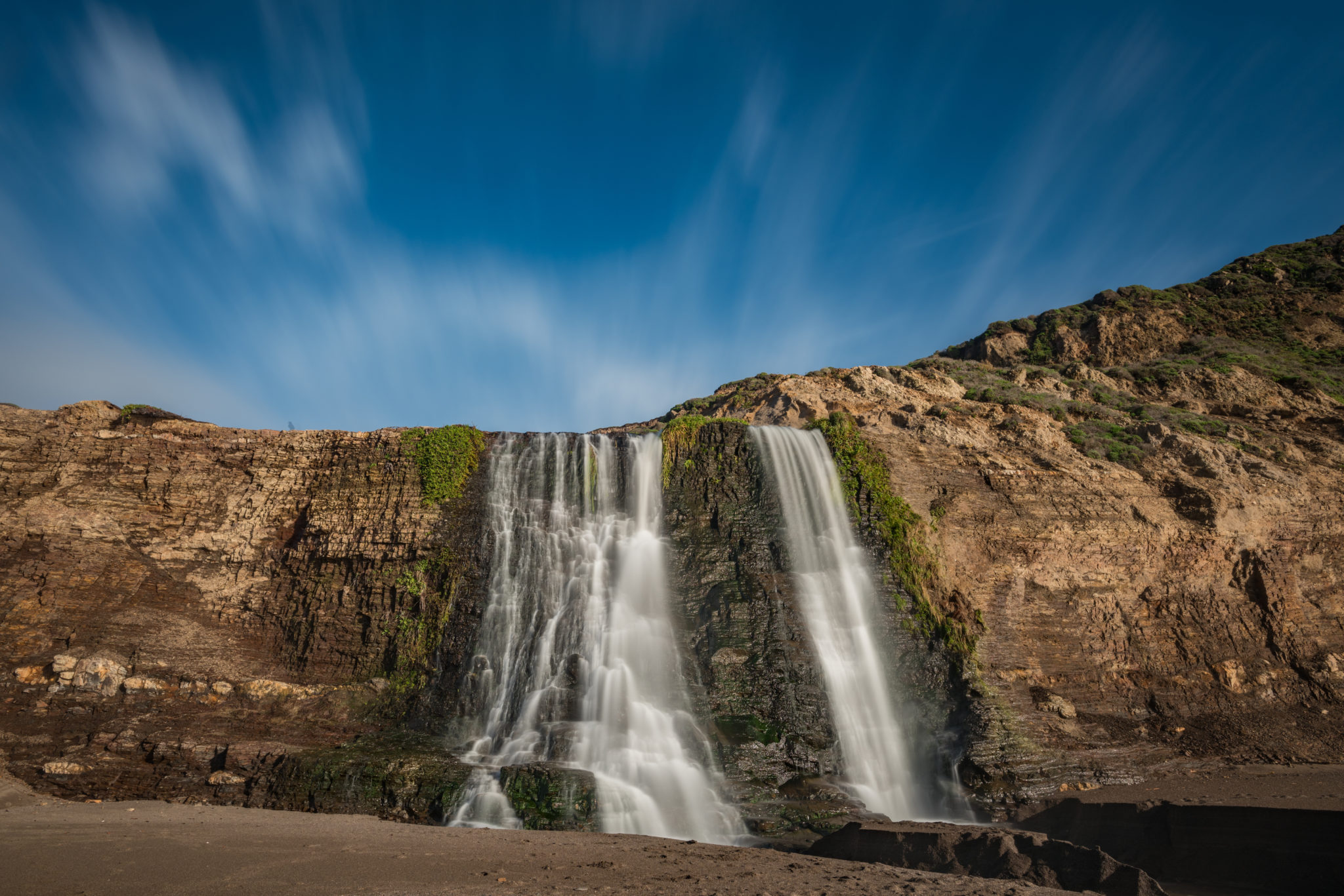
Phillips Gulch and Stengel Beach, Sonoma Coast
The Sonoma Coast is characterized by steep bluffs fronting beaches or coves. Small ravines that traverse the coastal forest and grasslands transport water seasonally. The water spills directly over the cliffs, creating lovely beach waterfalls. Two of the best ones are Phillips Gulch at Salt Point State Park and Stengel Beach at The Sea Ranch.
Take Highway 1 north of Jenner to the Stump Beach Cove parking lot at Salt Point State Park for Phillips Gulch Falls, and to the Stengel Beach lot for that site’s eponymous falls. Parking at both lots is free and access to each fall is easy. (Editor’s note: Stengel Beach access is temporarily closed to replace the wooden stairway to the beach.)
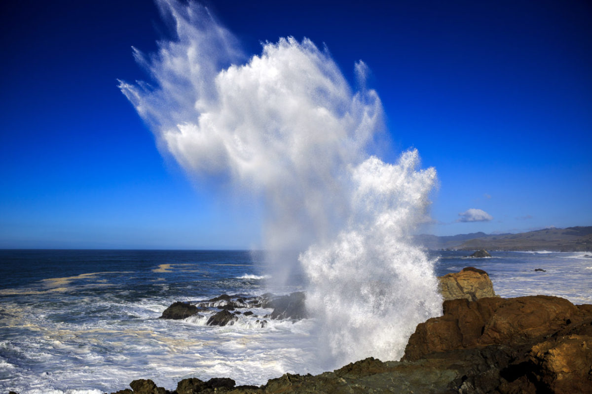
Waterfalls on the Sonoma Coast are most impressive when the water volume is highest — during storms. This can create something of a dilemma from December through March or beyond, because the seas are often tempestuous at such times. Visiting the falls post-storm and during a low tide, when the beaches can be strolled, is the wisest plan.
Salt Point State Park, 25050 Highway 1, Jenner, 707-847-3221, saltpoint.org
Stengel Beach, 37900 Highway 1, The Sea Ranch, 707-785-2377, parks.sonomacounty.ca.gov
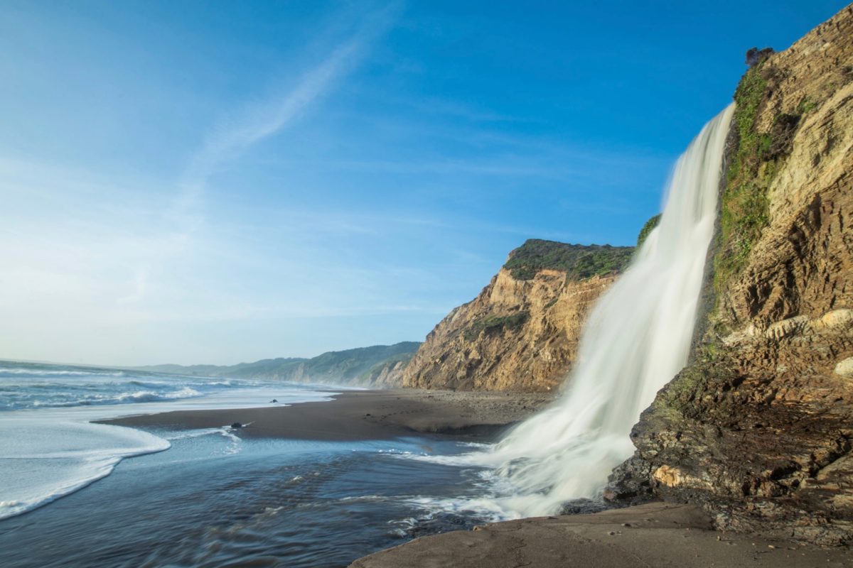
Alamere Falls, Point Reyes National Seashore, Marin County
Alamere Falls is a cascading coastal falls that bleeds over a slick, shale bluff onto an ocean beach. It is a rare “tidefall” that crests the edge of the continent near the southern end of the national seashore, also offering gorgeous coastal views that, on clear days, take in the Farallon Islands.
National park personnel ask all hikers to reach the Alamere Falls via Wildcat Campground, a bluff-top campground about a mile north of the falls. Hikers must traverse a mile of Wildcat Beach to get to the falls and then return to the trail, requiring careful consideration of tide and surf conditions. Do not go at high tide.
For North Coast residents, the most efficient and least crowded route to Alamere Falls starts inside the park at the Bear Valley Visitor Center at Point Reyes Station. Head coastward along the Bear Valley Trail to the Coast Trail, and then south to Wildcat Camp, a trip of about 6 1/2 miles. It’s another mile south on the beach to reach the falls.
Bear Valley Visitor Center, 1 Bear Valley Road, Point Reyes Station, 415-464-5100. nps.gov

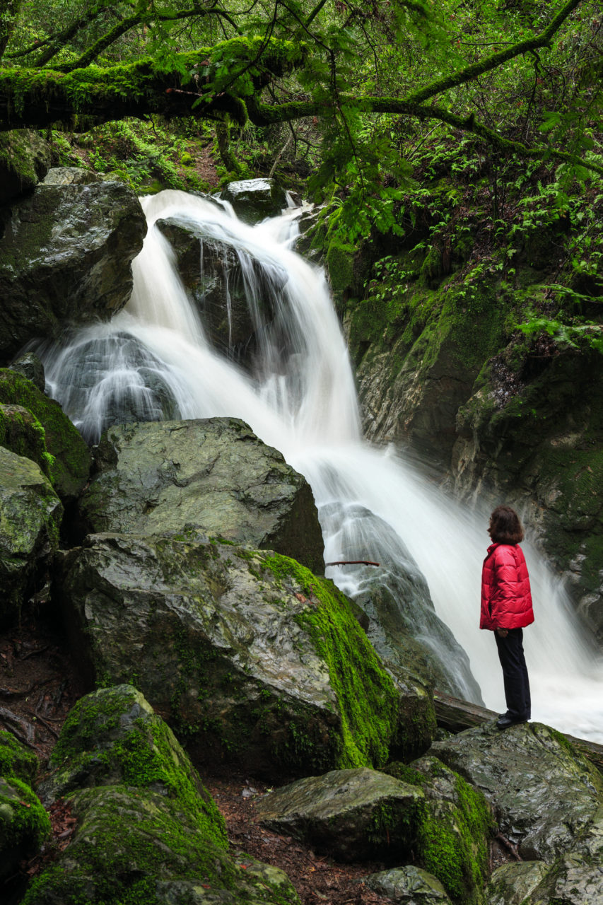
Cataract Falls, Mount Tamalpais Watershed, Marin County
The Mount Tamalpais Watershed houses a number of waterfalls, with one of the most popular being the picturesque cascades of Cataract Falls. The Cataract Falls Trailhead begins on Fairfax-Bolinas Road, hugging the southwest end of Alpine Lake. Follow the trail uphill past East Fork Cataract Creek and the Laurel Dell picnic area, after which the trail descends to the falls (approximately 3 miles).
For a longer but mostly flat hike, begin at the Rock Spring Trailhead off Ridgecrest Boulevard and travel north on Cataract Trail, which crisscrosses the creek several times. Just before you get to the waterfall on this trail, you’ll pass the junction of Cataract and Helen Markt trails where there’s a decent-sized pool to relax at. *Note: The Azalea Hill Trail to Cataract Falls is currently closed. Call the Mount Tamalpais Watershed or check online for more information on trail closures.
Mt. Tamalpais Watershed, 49 Sky Oaks Road, Fairfax. 415-945-1455, marinwater.org
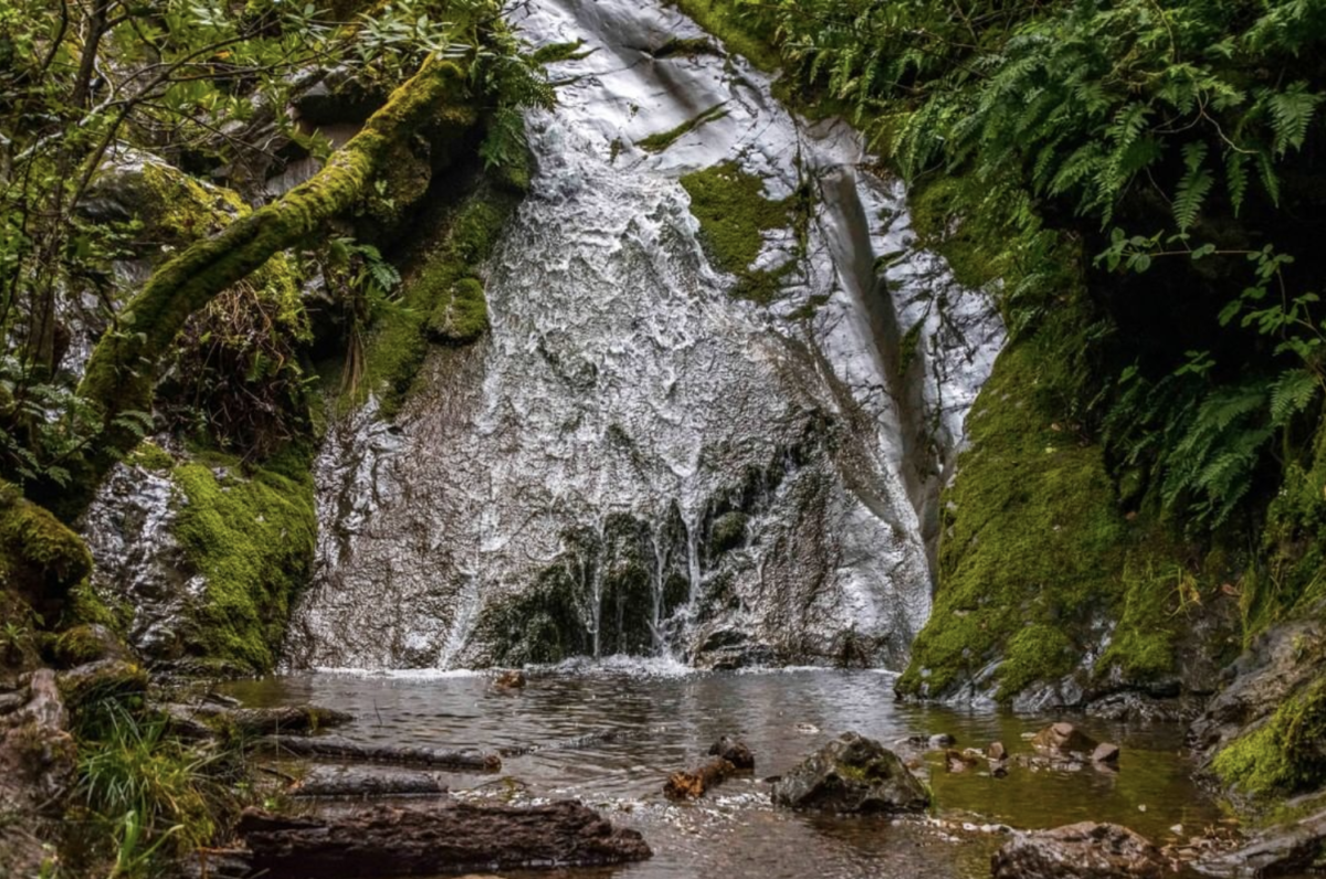
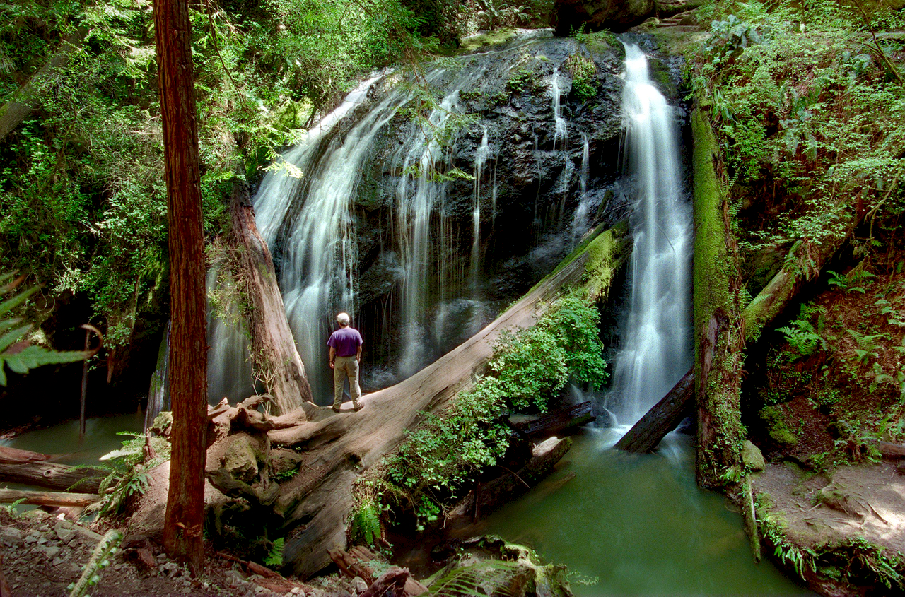
Carson Falls, Mount Tamalpais Watershed, Marin County
This gorgeous, multi-tiered waterfall is just under 5 miles west of Fairfax and has multiple simple routes to get there. The most popular path consists mainly of fire roads and begins at the junction of Fairfax-Bolinas Road and Pine Mountain Fire Road. Follow the rocky Pine Mountain Trail from the parking area for about a mile and turn left on Oat Hill Fire Road, which you walk for about 150 yards until you reach Little Carson Trail on the right. Travel down that trail for about a half mile to the falls.
Mt. Tamalpais Watershed, 49 Sky Oaks Road, Fairfax, marinwater.org

Steep Ravine, Mount Tamalpais State Park, Mill Valley
Three miles east of Marin’s famed Stinson Beach, Webb Creek flows through Mount Tamalpais State Park’s wooded Steep Ravine, creating a number of modest, tranquil waterfalls surrounded by foliage. The rugged Steep Ravine Trail — the only trail in Marin that features a ladder (nearly 15 feet in length) — begins at the Pantoll Campground on Coastal Fire Road off Panoramic Highway and meanders southwest along the creek. The full trail stretches about two miles down to Highway 1 near Rocky Point Road, but this trail can be combined with the Dipsea and Old Mine trails to create a 3.5-mile loop that has spectacular views of both the redwood canyon’s waterfalls and the city skyline.
Mount Tamalpais State Park, 3801 Panoramic Highway, 415-388-2070, parks.ca.gov
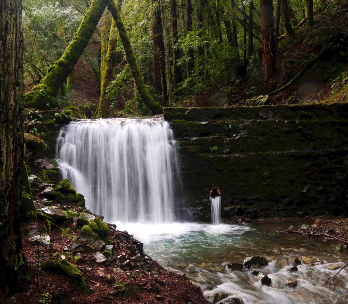
Cascade Falls, Cascade Canyon Open Space Preserve, Fairfax
The trout-laden Cascade Creek flows through the lush evergreen forests of this preserve and spills down the serene Cascade Falls. The 1.5-mile out-and-back hike to the falls is easy, lightly trafficked and accessible year-round, making it an ideal waterfall hike for the whole family. From the crook in Cascade Fire Road near Middle Fire Road, simply walk along Cascade Falls Trail for about six minutes to reach the falls. *Note: There is a second, smaller Cascade Falls in Marin at Mill Valley’s Cascade Park, a short and simple hike (about a quarter mile) near some suburbs.
Cascade Canyon Preserve, 26 Oak Road, Fairfax, parks.marincounty.gov
Buck Gulch Falls, Ignacio Valley Preserve, Novato
This rippling, fern-encased waterfall lies at the northernmost edge of the preserve, which is easily accessible starting from the end of Fairway Drive. Saunter west on the Buck Gulch Falls Trail, which begins paved then narrows and turns into a dirt path, for a little over half a mile to reach the falls. This short, beautiful waterfall hike is great for kids as well as dogs (on a leash).
Ignacio Valley Preserve, 611 Fairway Drive, Novato, parks.marincounty.gov
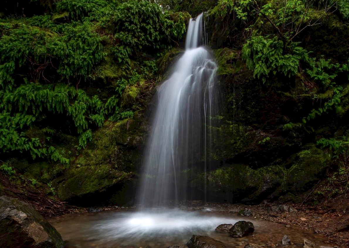
Ken Harth Waterfall, Indian Valley Open Space Preserve, Novato
Wander through Indian Valley Preserve’s nearly 560 acres of oak, bay and madrone forests during the rainy season and you’re sure to stumble upon Ken Harth Waterfall, a rushing, 10-foot cascade down a sleek, mossy rock face. The Waterfall Trail can be accessed easily from the Indian Valley Fire Road that extends from the College of Marin’s Indian Valley campus off Ignacio Boulevard, a hike just under a mile. If you want to make the most of your falls trek, walk the fire road south past Pacheco Pond and traverse the switchbacks along the loop of Ken Harth Waterfall Trail (and maybe take a detour on Susan Alexander Trail to check out some wildflowers and black oaks).
Indian Valley Preserve, from Indian Valley Campus at 1800 Ignacio Blvd., Novato. parks.marincounty.gov

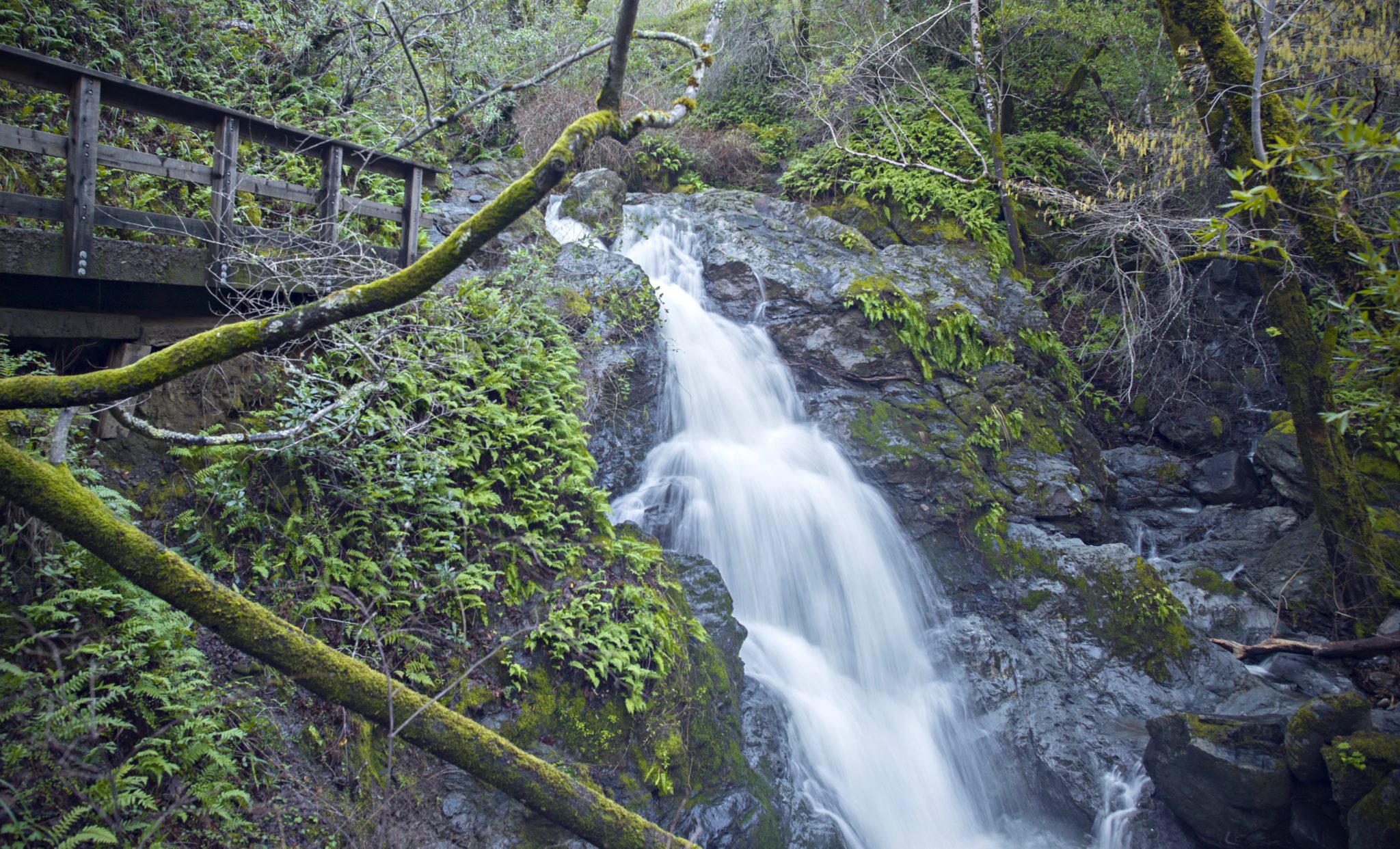
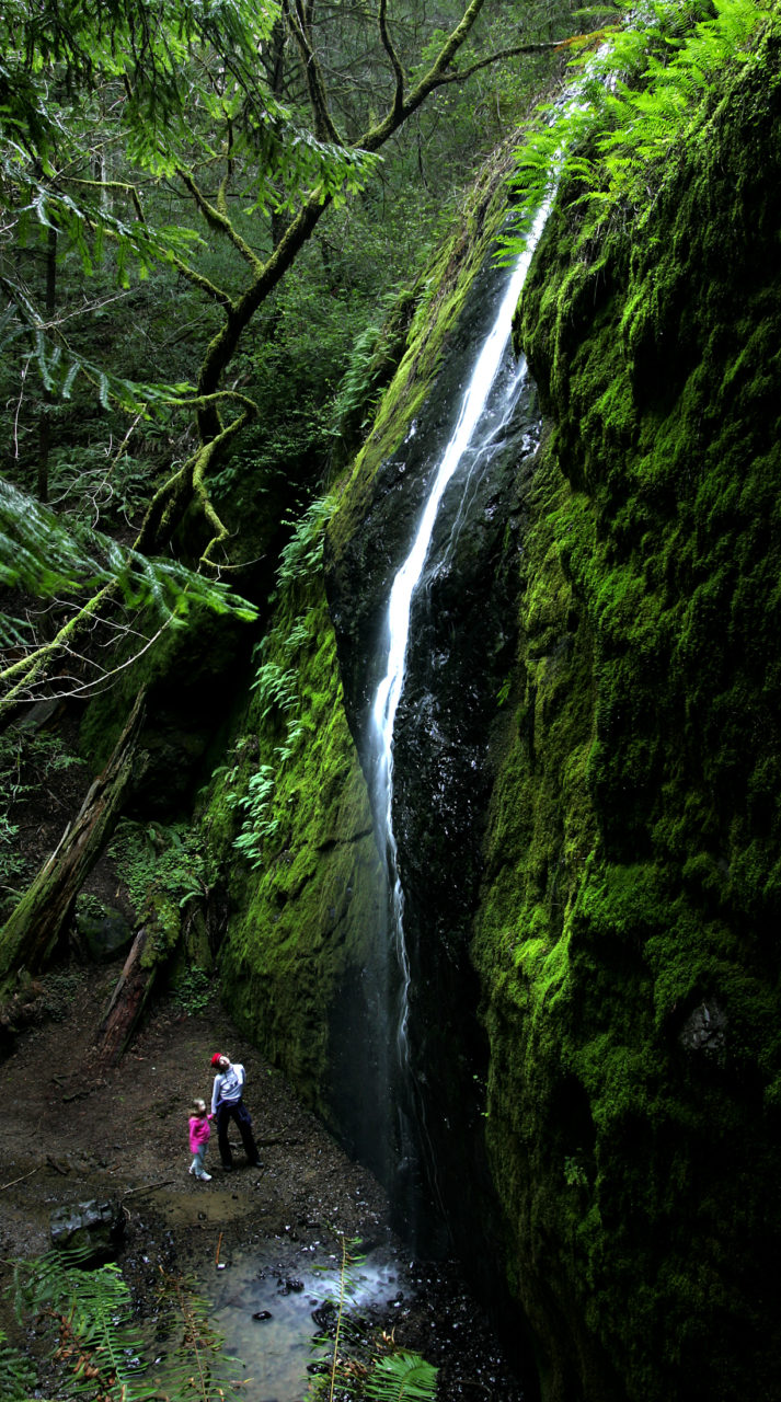
Dawn Falls, Baltimore Canyon Open Space Preserve, Kentfield
A few miles west of Larkspur sits this 193-acre preserve’s blissful, babbling Dawn Falls. The easiest way to get there is to start from the western edge of Madrone Avenue where it meets Valley Way and follow Dawn Falls Trail along the redwood-lined Larkspur Creek for just over a mile to the falls. You could also access the waterfall from the falls trail entrance on Southern Marin Line Fire Road — a 10-minute walk starting from the Crown Road trailhead that’s a half mile north of the falls.
Baltimore Canyon Preserve, from Madrone Avenue at Valley Way, Larkspur, or 415 Crown Road, Kentfield. parks.marincounty.gov
Tucker Trail Falls, Mount Tamalpais Watershed, Kentfield
Phoenix Lake, on the east side of the watershed, feeds into Bill Williams Creek below with canyons forming several small waterfalls flowing between the flora and foliage around the route that hugs it: Tucker Trail. The best way to access this trail is from the Harry Allen Trail on Phoenix Road (off Crown Road west of Kent Woodlands), walking down the path for about a quarter of a mile and turning left on Tucker Trail. The route intertwines with the creek a few times and ends at Eldridge Grade Fire Road; a moderate, 3.4-mile out and back trail. For a more varied hike on the way back, take Bill Williams Trail, which runs along the other side of the creek and is spotted with several wooden bridges.
Mount Tamalpais Watershed, from Harry Allen/Tucker Trailhead at 9 Phoenix Road, Kentfield. marinwater.org
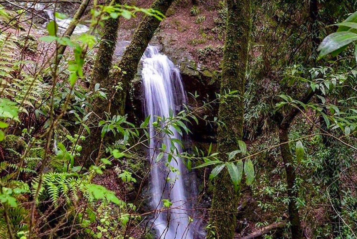
Fern Canyon Trail, Russian Gulch State Park, Mendocino
Though a popular Mendocino Coast walk, there is nonetheless something intimate about the hike up Fern Canyon to the 36-foot waterfall in Russian Gulch State Park. Delicate ferns line the canyon and woodland trees and draw visitors onward as they follow the meandering creek along the canyon floor. You can get right up close to the broad stone face of the waterfall and stand amid fallen trees, or hike above the falls, taking care not to slip on wet rocks.
Russian Gulch State Park is located at 12301 North Highway 1, about 2 miles north of the town of Mendocino. The trail starts at the east end of the campground and follows an old logging road with crumbling asphalt for the first 1.9 miles. A bike rack marks the point where the flat, paved trail starts to incline, offering two alternate, hiker-only routes to the waterfall — one a straight, out-and-back leg 0.7 miles long, for a 5.4-mile round-trip, and the other a 1.6 mile loop, for a total 6.3-mile walk.
Russian Gulch State Park, 12301 North Highway 1, Mendocino, parks.ca.gov
Chamberlain Creek / Waterfall Grove Trail, Jackson Demonstration State Forest, Fort Bragg
This remote, narrow waterfall east of Fort Bragg draws visitors deep into Jackson State Demonstration Forest off Highway 20. Even if there were no waterfall to see here, the short hike into virgin redwood forest is like a trip into an enchanted land, where brilliant green moss coats the rocks and fallen timber amid majestic redwoods that have stood tall for centuries. To get to the Chamberlain Creek Waterfall, start on West Chamberlain Road 4.5 mils north of Highway 20 and head down the out-and-back Waterfall Grove Trail for about 2 miles.
Jackson Demonstration State Forest, 802 N. Main St., Fort Bragg, fire.ca.gov
Maci Martell contributed to this article.