Written by Robert Stone for the Press Democrat.
Pomo Canyon Campground sits on the alluvial flats above broad Willow Creek canyon in a beautiful redwood grove. The Pomo Canyon Trail begins at the campground and winds across the rolling coastal hills, skirting the north slope of Red Hill.
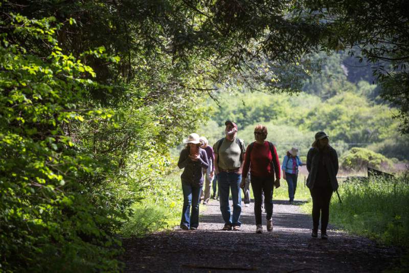
The trail follows an ancient trading route of the Pomo and Miwok people. The path weaves through lush redwood forests, oak woodlands and open grasslands, crossing seasonal streams en route to the ocean at Shell Beach.
From the trail are panoramic vistas of the lower Russian River, Willow Creek, the town of Jenner and the serrated coastline.
From Highway 1 and Highway 116 (just south of Jenner) cross the south side of the Russian River bridge on Highway 1. Immediately turn left (inland) on Willow Creek Road at mile marker 19.79. Drive 2.6 miles on the narrow road to the Pomo Canyon Campground turnoff. Park near the gated road (but not in front of it). The campground is open from April through November. During that time, drive a half mile up the campground road and park by the kiosk.
From Bodega Bay, drive 9 miles north on Highway 1 to Willow Creek Road at mile marker 19.79. The road is just before the Russian River bridge. Turn right (inland) and follow the directions above to the Pomo Canyon Campground.
Shuttle car
8901 Hwy 1 • Jenner
38.418837, -123.101977
Leave the shuttle car at the Shell Beach parking lot. The turnoff is located at mile marker 18.22 along Highway 1.
The Hike
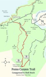
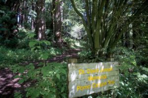
From Willow Creek Road, walk past the gate and follow the unpaved campground access road. Stroll a half mile through a grassy valley between forested hills to the campground entrance. Head into the campground on the right as the road veers off to the left. Go 15 yards and bear right on the posted Dr. David Joseph Memorial Pomo Canyon Trail.
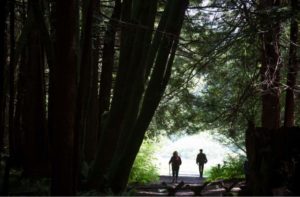
Enter the gorgeous redwood forest and stay to the right, passing two paths on the left and the campsites on each side of the main trail. Climb up the ridge through tanbark oak, bay laurel, Douglas fir, circular stands of redwoods, sword ferns, and trillium. Emerge from the forest to a Y-fork at 0.8 miles, located in a clearing with views of Jenner and the mouth of the Russian River.
The left fork leads to the 1,062-foot summit of Red Hill and forms a loop with this trail — an optional return route.
Stay to the right towards Shell Beach, and traverse the hill. Cross a bridge over a seasonal creek and curve right, skirting a rock outcrop. Descend through brush to the open, rolling slopes with ocean views. Cross a small stream and reenter a fir and redwood forest. Cross a third stream and gradually descend through the thick brush.
Curve left into the gulch, cross the creek, and head down the draw. Ascend the hill to a knoll with a picnic area and vista point on the right. The main trail continues straight, with a view of the serpentine Russian River. Head up another hill on the wide, grassy path to a knoll atop the 500-foot oceanfront ridge and a junction with the west end of the Red Hill Trail.
Pass a trail on the right leading to Lookout Hill, then descend the slope, with views of Point Reyes, Bodega Head, Gull Rock, and Goat Rock. Drop down a partially paved utility road to the trailhead gate, across the road from the Shell Beach parking lot.
Pomo Canyon Campground to Shell Beach
Sonoma Coast State Park
Hiking distance: 6.6 miles round trip
3.3-mile one-way shuttle to Shell Beach
Hiking time: 3.5 hours
Configuration: out-and-back
Elevation gain: 650 feet
Difficulty: moderate
Exposure: a mix of forest and open hillsides
Maps: USGS Duncan Mills • Sonoma Coast State Beach map
To the trailhead
Willow Creek Rd. • Jenner
38.430110, -123.070255
Source: “Day Trips Around Sonoma County” by Robert Stone (Dayhike Books, 2016)


