


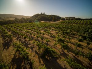


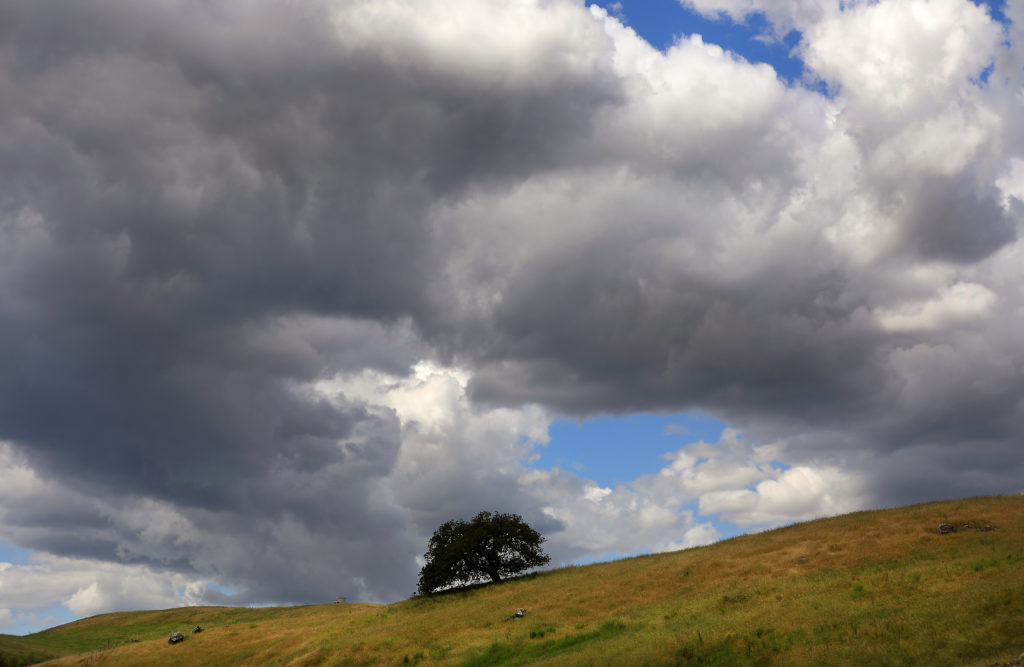


It was the first visit to Pepperwood Preserve for the California Naturalist Program, an effort to train citizen stewards for the protection of the state’s wildlands. About 100 excited participants convened on a hot, dry day in October 2017 for field tours at the preserve, a stunning 3,200-acre living laboratory of conservation science ensconced in the Mayacamas Mountains just northeast of Santa Rosa.
Many of the naturalists had camped on the grounds the night before, and they had been invited to stay over for another evening. By the time night had fallen, Lisa Micheli — who is charged with overseeing the preserve — was back in her home in eastern Sonoma. And with the darkness came wind. A lot of wind.
“I went to bed and listened to the gusts, and I just didn’t like it,” says Micheli. “I thought, ‘This is fire weather.’ But for the first time in my life — and the last time, as it turned out — I set my phone to Do Not Disturb. I was doing a lot of international work then, and I was getting pinged from colleagues at all hours, and I just needed to get some sleep.”
Micheli was roused by 6 a.m., and the first thing she noticed when she looked outside was an ominous red glow on the horizon. Then she checked her phone: 45 messages.
“The first one I read was from Cassandra Liu, our operations and finance manager, and it said, ‘Everyone confirmed alive.’ The one before that read, ‘Pepperwood is burning,’ and the one before that was ‘Sonoma County is on fire.’ I could fill in the blanks from there. I just went into full emergency mode, and didn’t go back to my house for three weeks.”
That was partly because Micheli’s home ended up in a fire evacuation zone, and partly because her duties at Pepperwood were suddenly all-consuming. The flames from the Tubbs fire scorched most of the preserve and eventually burned all the way to Santa Rosa, destroying 5,600 homes and other structures and killing 22 people. The disaster kept staffers at bay for four days.
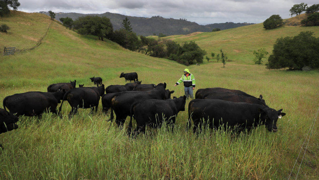
“It took some time in the first hours to confirm that no one had decided to stay overnight and that everyone was OK,” says Micheli. “That was the critical issue. I was finally able to get up to the property on the 12th with a sheriff ’s escort. We have about 125 cattle that are integral to our range research, and we had to get feed to them.”
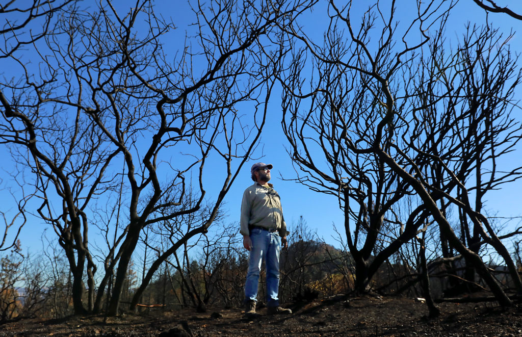
The firestorm had burned 95 percent of Pepperwood, destroyed the preserve manager’s home, a guesthouse, the main supply barn and field office, an astronomical observatory, and various sensor stations and pieces of heavy equipment. The loss was devastating. Yet no one on staff felt they had the luxury of extended mourning.
“We called our insurance company right away and got that moving,” Micheli says. “The Santa Rosa Foundation lent us their facilities for staff meetings and the Sonoma Land Trust provided cubicles for workspaces. We worked with specialists to clean up and restore services to the Dwight Center [the preserve’s office complex], and by Thanksgiving we had reoccupied it and were back up to speed. And one of our first major meetings was on fire science work — figuring out what we should be measuring.”
There is a certain irony to that priority, given it was foreshadowed during the naturalist rendezvous the day before the fire, acknowledges Tosha Comendant, Pepperwood’s conservation science manager. She had led a field tour on climate change impacts with Stu Weiss, the chief scientist at the Creekside Center for Earth Observation in Menlo Park.
“Fire was a topic of discussion, given the red flag warnings and single-digit relative humidity,” says Comendant. “It was an incredibly strange and heavy experience to have been participating in the climate field trip during the day to raise awareness of fire risk, and then have our projections realized.”
Along with buildings and equipment, the flames destroyed multiple research projects that were underway or planned. Pepperwood’s expansive acreage encompasses a rich array of habitats, from grasslands to coniferous forest to hardwood savanna. Researchers converge from around the state and nation to study wildland ecosystems, wildlife, and climate change. The preserve is thus a prolific generator of data on the shifting forces that are shaping the environment. But while the Tubbs fire laid waste to many of the preserve’s projects, it set the stage for a vast array of new studies that are likely to drive research for years to come.
“The fire was a human tragedy, not an ecological tragedy,” says Micheli, whose official role at the preserve is president and CEO. “We’ve been working on wildfire and climate research for a long time. We have 32 grassland monitoring stations and 50 forest stations. At many locations we have data that date back five to 10 years, and the fire didn’t make that disappear. It just gave us new things to observe and monitor.”
Pepperwood was owned by the California Academy of Sciences until 2005, when it was sold to former Optical Coating Laboratory CEO Herb Dwight and his wife, Jane. The Dwights sit on the preserve’s board and have donated more than $20 million to infrastructure development and management.
Pepperwood’s mandate includes inquiry into all facets of conservation science, including climate change. Wildfire trends and impacts always have been part of that mission, given both the connection to a warming planet and landscape impacts. But the Tubbs fire and its aftermath lent particular urgency to that work.
Indeed, Pepperwood plays a critical role in statewide wildfire research. Most of the available fire data comes from Southern California and the Sierra Nevada; relatively little exists for the mixed montane ecosystems of the North Coast.
“But we have that baseline data,” Micheli says, “and we’re jumping on as many fire-associated projects as we can think of. We’re filling a gap.”
California is a fire-adapted landscape. It’s not a question of if it will burn, but when. Moreover, it’s generally true that it must burn for optimal wildland health. Many native species of flora are “serotinous,” meaning they require fire to successfully germinate and grow. Fire consumes the thick thatch that inhibits a variety of native plants in grasslands. It opens up dense brush fields and heavily stocked woodlands, allowing surviving trees to reach lofty sizes and creating a rich assemblage of “edge” habitats that increases wildlife diversity.
Some of Pepperwood’s data pointed to a pre-Tubbs fire landscape that was out of balance. Decades of overzealous wildfire suppression — pouncing on every blaze that sent a wisp of smoke into the air — had allowed heavy stands of fireintolerant Douglas fir to invade habitats previously dominated by oaks. This change led to potentially catastrophic wildland fuel loads and also reduced biological richness: Oak woodlands typically support far greater biodiversity than young, thick stands of Douglas fir.
Pepperwood’s researchers have long been interested in using deliberate and controlled — or “prescribed”— fire to reduce fuel loads and encourage diversification in woodland communities. Indeed, a sizable chunk of forest, much of it Douglas fir, was scheduled for such a prescribed burn just before the Tubbs fire rolled through. Though the details of the research project necessarily changed, says Micheli, “it’s still moving forward. The burn was more intense than we planned, of course, but we’re monitoring, measuring and recording.”
Calculating the need for prescribed fire entails sophisticated technologies — among them LIDAR (Light Detection and Ranging), essentially the same tech that police now use to nab speeding motorists. In Pepperwood’s case, LIDAR involves situating pulse lasers in aircraft to measure features on the earth’s surface in precise 3D detail. LIDAR can be fine-tuned to obtain information on the forest subcanopies — the limbs, branches, and leaves along tree trunks. Such foliage can form “fuel ladders” from the ground to the tops of the trees, with relative density constituting a key indicator of wildfire intensity potential.
“We’ve found that heavy ladder fuels closely correspond to where fires burn the hottest,” says Micheli.
Pepperwood is also spearheading an ambitious project with UC Berkeley that assesses fire risks for Marin, Napa, and Sonoma counties. The initiative employs a wide range of datasets from the preserve and elsewhere to pinpoint hazards at a fine scale — not just ladder fuels, but meteorological information, existing structures, powerlines, and a variety of other factors. That can improve both fire prevention and fire response to an immense degree, says Micheli.
“It can tell you priority areas for fuel treatment, where you might want to stage equipment and crews during high fire hazard conditions or during a fire, and where you might want to shut down the power grid during dangerous fire conditions,” she says.
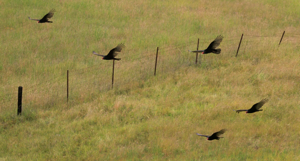
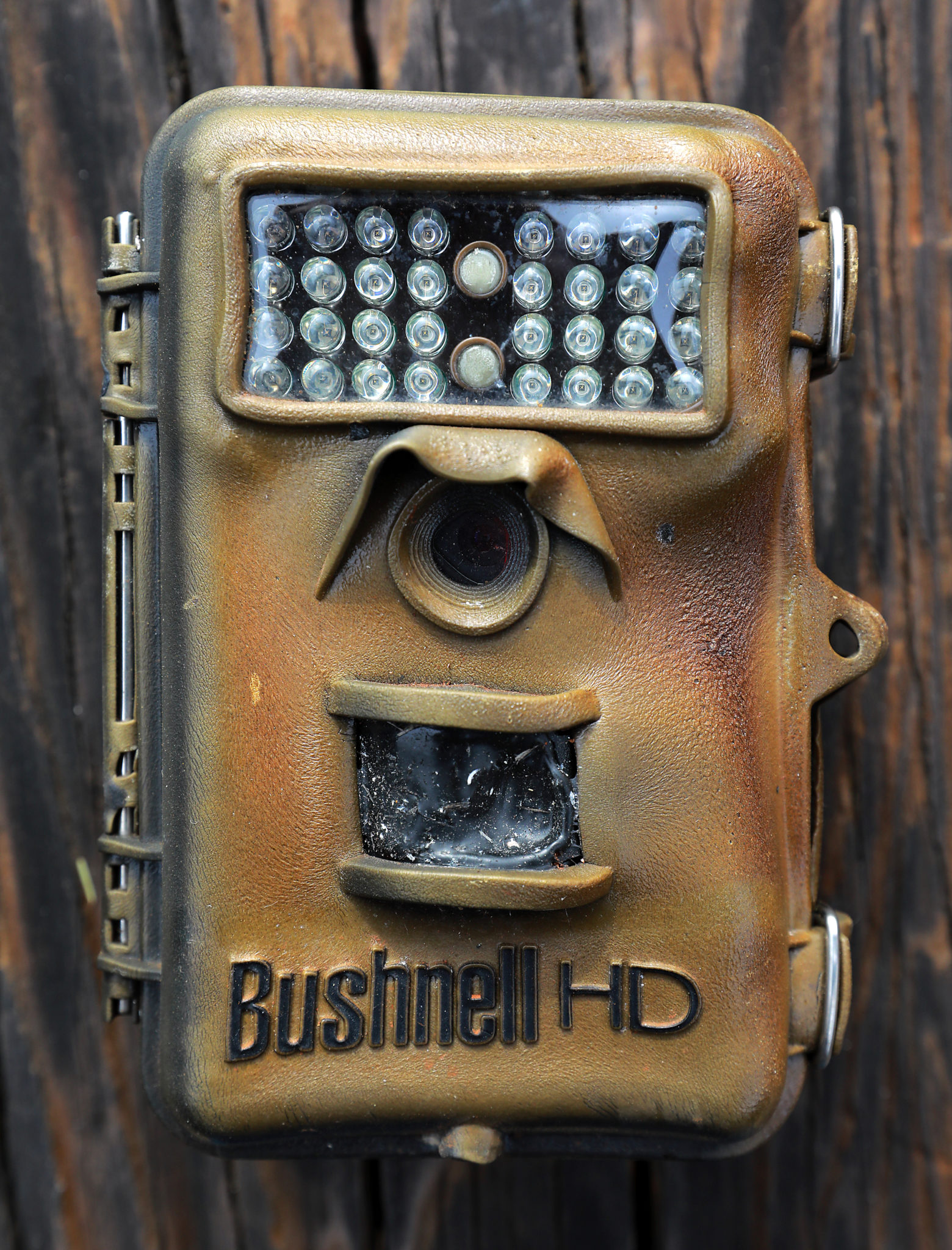
Pepperwood is replete with motion-sensitive wildlife cameras and monitoring stations that record daily temperatures, wind, precipitation, soil moisture, leaf wetness, streamflow, and a variety of other environmental factors. Some of the equipment had to be repaired or replaced after the Tubbs fire, but as the months have spooled out since the blaze, some fascinating trends are emerging. As confirmed by the cameras, wildlife generally recovered quickly. There were individual casualties, of course, but few if any devastating impacts to species. Larger animals — black-tailed deer, mountain lion, black bear, bobcat, gray fox, jackrabbits, wild turkey — simply moved out of the way of the flames, then recolonized the property.
“Herps” — reptiles and amphibians — literally went to ground during the fire, retreating to burrows. Pepperwood has always been and remains an avian haven, but the fire rearranged species distribution.
Recent breeding bird surveys indicate lazuli bunting and western wood peewee, for example, are doing well, but wrentit and California quail have declined in numbers.
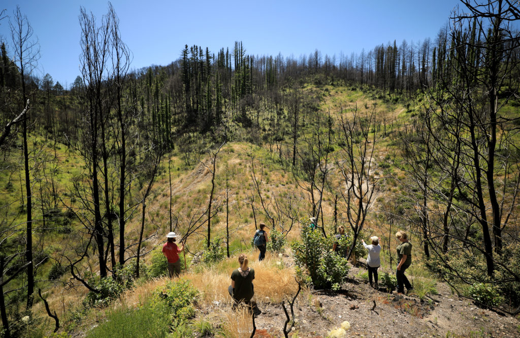
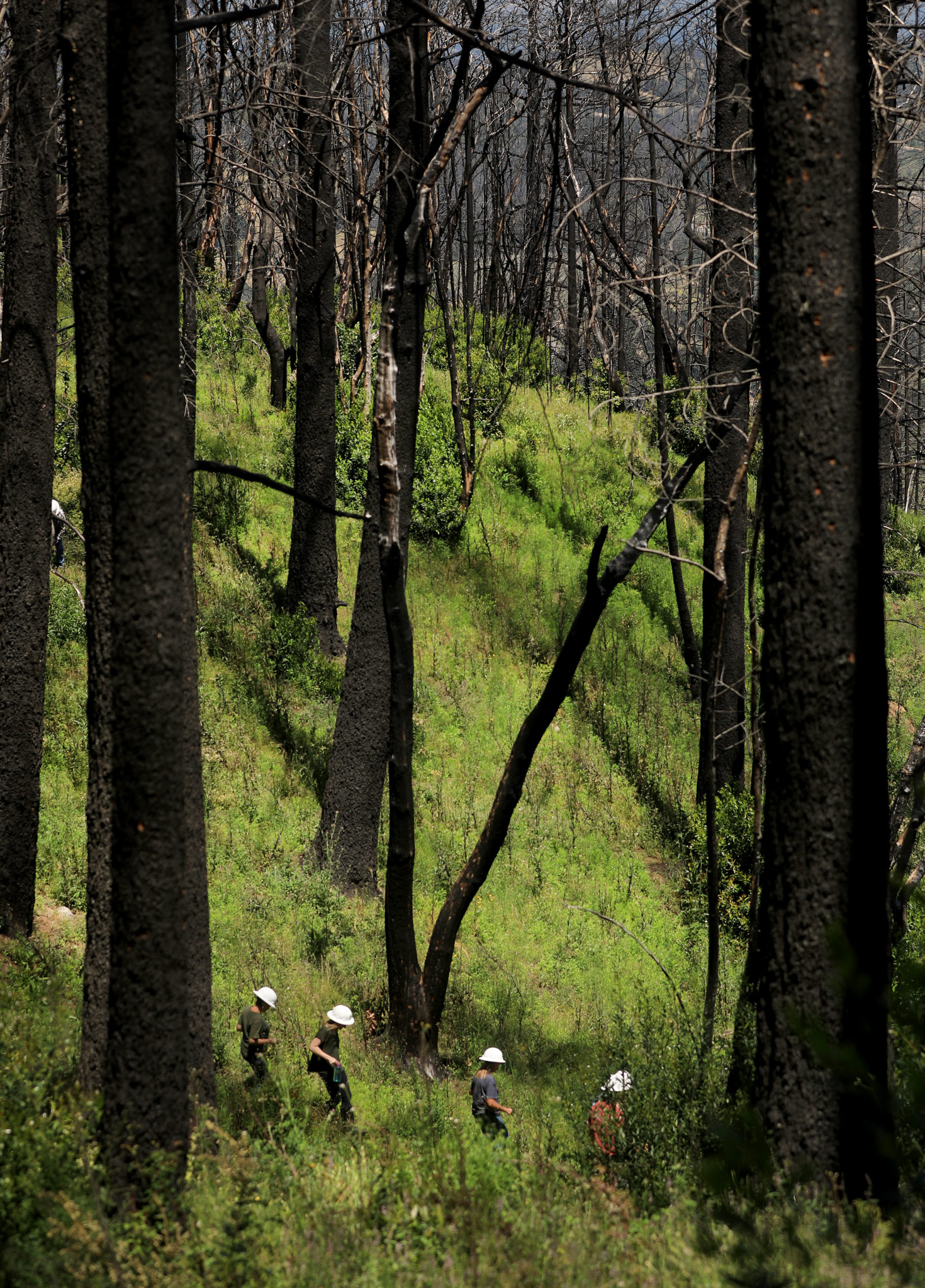
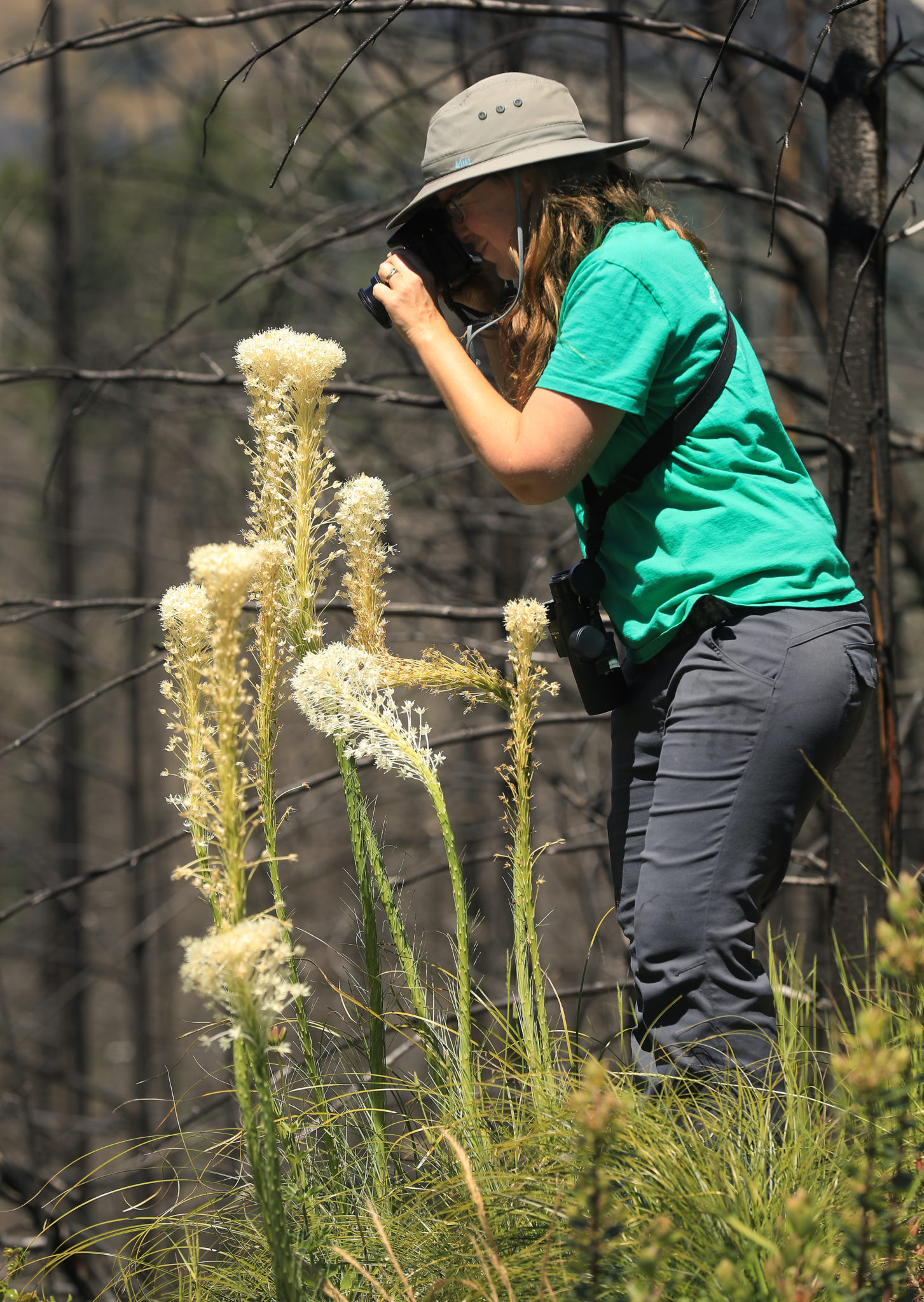
A tour of the preserve with Comendant, the conservation science manager, and research technician Ryan Ferrell confirms a landscape of almost excruciating beauty, one seemingly far removed from natural disaster. The day is nothing short of spectacular: deep cerulean skies and abundant golden sunlight. A gentle breeze, scented with spring verdure, soughs through the forests.
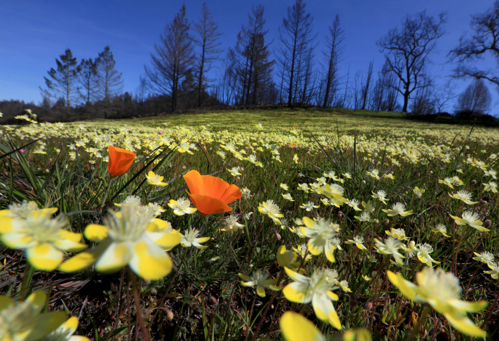
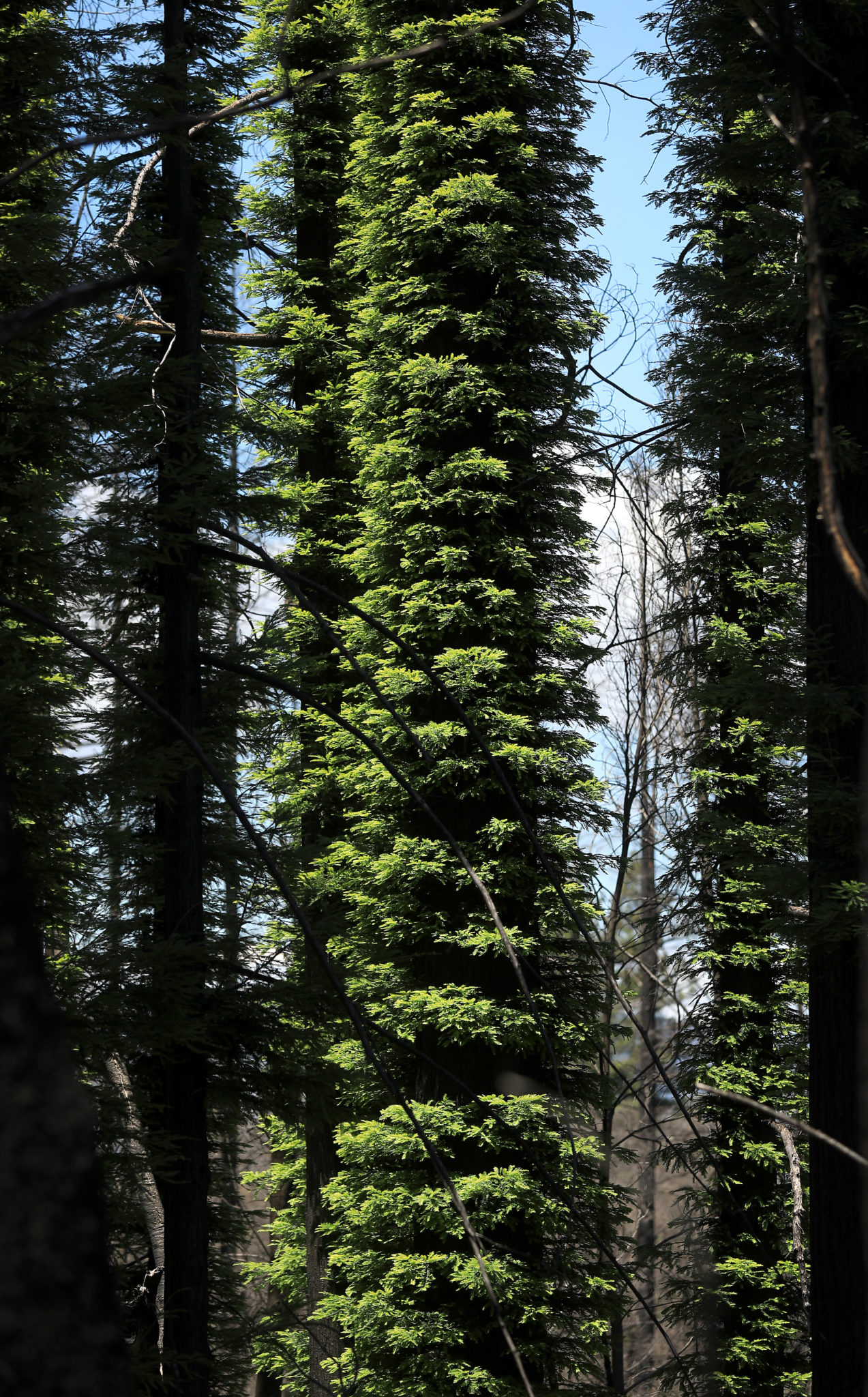
Most of the Douglas fir, it seems, have been killed outright; their charred, skeletal remains are now commissaries and nesting sites for acorn woodpeckers and flickers. In the oak woodlands, the understory that was so thoroughly scoured by the flames is returning. Tangles of poison oak are everywhere, along with wild irises and an exquisite lemon-yellow lily known as Diogenes’ lantern.
“There were huge numbers of them during the winter and spring following the fire,” says Comendant. “We’re seeing fewer of them now.”
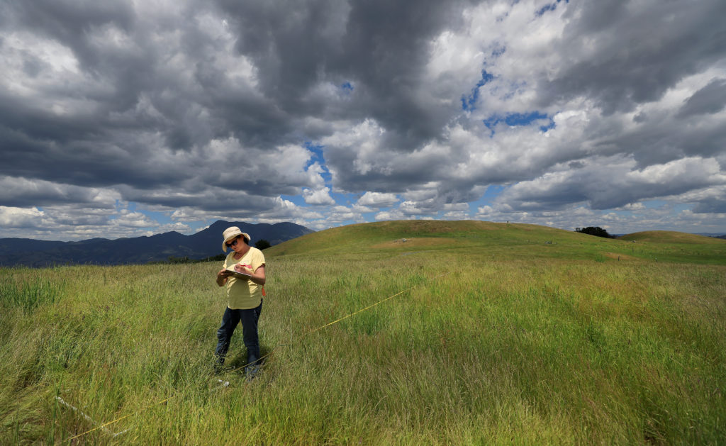
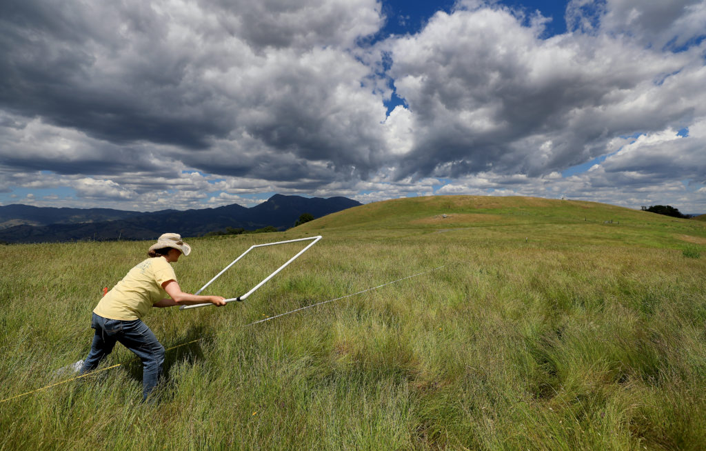
Researchers are meticulously documenting these shifts in plant growth across Pepperwood’s landscape. Such work includes 37 long-term study plots and 17 “super plots” — 20×20-meter plots of ground in which every woody plant is painstakingly measured with calipers and recorded. The studies show that the Tubbs fire was a slate cleaner for native flora distribution, an ecosystem disrupter that allowed the germination of many plants that hadn’t been recorded at Pepperwood for years — if ever. Since the blaze, botanists have identified 12 “fire-following” plants that were never before seen on the preserve and 23 herbaceous species new to the forested plots.
The post-fire resurgence of wildlife is dramatic.
The apex predators such as mountain lions and black bears are unlikely to be seen by hikers, but are confirmed through the preserve’s motionsensitive cameras. Birdsong is almost incessant in both the forests and grasslands; raptors of various species seem always to be soaring overhead or juking through the trees; black-tailed deer browse the understories. And butterflies, most notably California sisters and pipevine swallowtails, are everywhere, a testament to the variety and abundance of food plants.
Most of the big oaks survived the fire, though they were severely scorched; emergent green shoots are now thick along their trunks and branches. Pepperwood supports a number of oak species, including Oregon oak, which is close to the southernmost limit of its range here.
There are some indications that it might retreat northward due to the effects of climate change, says Comendant; there’s also evidence that Oregon oaks are hybridizing with blue oaks on the preserve. That begs the question: Is this strictly a North Coast phenomenon, or are oak distributions — even oak species — broadly changing due to a warming climate? Such research underscores the significance of Pepperwood as a key base of study for climate change. Due to the meticulous measurements and record-keeping that are ongoing here, researchers will be able to quantify the regional impacts of global warming — literally oak-by-oak in some cases.
Hiking with Comendant and Ferrell, it’s hard to see the dynamic shifts that are occurring at Pepperwood. There is a glorious — if misleading — sense of immutability to the forests and meadows, to the far, dusty blue ridges that ring the horizon. The sunlight is dazzling, almost a physical impact, as the two colleagues walk from the shadowed oak groves to the lush, Kelly green grasslands. The wildflowers are at their peak, with spectacular blooms of blueeyed grass and California poppies spangled across the slopes. Ferrell kneels down and picks at a clump of grass.
“Harding grass,” he says. “It’s a non-native species, and fairly hard to eliminate. The irony is that it was widely seeded as an erosion control measure following the Hanley fire in 1964, which had the same general footprint as the Tubbs fire. It grows rapidly and anchors the soil. But now we want to eliminate it — along with numerous other invasive plants — to favor native species.”
Major disruption events like hot, intense wildfires favor the propagation of invasive species, observes Comendant. But low-level prescribed fire can inhibit invasives, depending on where and when it’s applied, making it a valuable tool for grassland restoration. But that isn’t the only option. Comendant points to some black hulks on a distant hillside: Angus cattle.
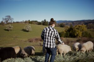
“Livestock can be an extremely effective means for controlling invasive plants,” she says, “but you have to use them in the right way. Typically, ranchers may leave their livestock in a pasture for a long period of time, allowing them to gnaw the forage close to the soil. That encourages invasives — it’s a major disrupter. But if you allow the stock to graze intensively for a short period and then move them to a new area, it mimics the grazing patterns of native wildlife, like tule elk. That favors bunchgrasses and other native species. So we use livestock operators who agree to rotate their stock according to our needs.”
Invasive species aren’t limited to flora. Pepperwood supports abundant native reptiles and amphibians, including California newts, black salamanders, and imperiled yellow-legged frogs. Most of the amphibian species breed in the preserve’s ponds and vernal pools and retreat to burrows, where they lie dormant from late spring to the first heavy winter rains. But the indigenous newts and frogs are imperiled by tough, fecund non-native bullfrogs, which will eat virtually any living creature they can cram down their voracious maws — including tadpoles and full-grown newts. Pepperwood works with contractors to control bullfrogs, but complete extermination is difficult. The chunky batrachians will migrate long distances, and a pond that has been cleared of bullfrogs one year is likely to see a fresh crop the following wet season.
That’s made clear when Comendant and Ferrell hike the edge of a small evanescent pond, and the strident “gleep” of an alarmed bullfrog resounds, followed by a loud splash. Ferrell looks mildly pained.
“We’d removed bullfrogs from this pond, but we’ll have to come back now to deal with these new guys,” he says. “Bullfrog control is an ongoing, long-term commitment.”
After the frog encounter, Comendant and Ferrell hike up a high grassy knoll — prosaically named Hill 1524 — to examine a recently installed fire camera, one of two such devices at Pepperwood. The cameras link with 40 identical devices now operating or scheduled for imminent installation in Sonoma, Napa, Marin, Mendocino, and Lake counties, providing realtime images of the entire North Bay landscape to emergency dispatchers, first responders, and the public at large. Their value is self-evident: Early detection of wildfire, its direction, and rate of spread can save lives and property.
“These cameras are going in everywhere across the North State,” says Comendant. “You can click on the website AlertWildfire.org and get live feeds. We anticipate they’re going to be incredibly important for wildfire preparation and response.”
All of the sensors and cameras, all the data that is captured on an ongoing basis, are thus significant for environs well beyond Pepperwood’s boundaries. The preserve is the prime mover in a highly ambitious regional conservation initiative, the Mayacamas to Berryessa Landscape Connectivity Network (M2B). Last year, Pepperwood announced six high-priority habitat conservation corridors that could serve as critical connections to existing protected areas running from the northern end of San Pablo Bay to the rugged Berryessa Snow Mountain National Monument.
Pepperwood has been working with a range of managers and scientists, combining knowledge gained at the preserve and elsewhere with the latest climate change projections to identify habitat corridors for wildlife in the area. “It’s really heartening that local park and land trust organizations are working on development and implementation projects for every one of these corridors,” says Micheli.
The corridor plans include both outright land purchases and conservation easements, and should ultimately improve conditions for native plants and wildlife across a huge swath of the North Coast. Further, land managers are looking at those protected lands as places where they could deal more proactively with fire, says Micheli.
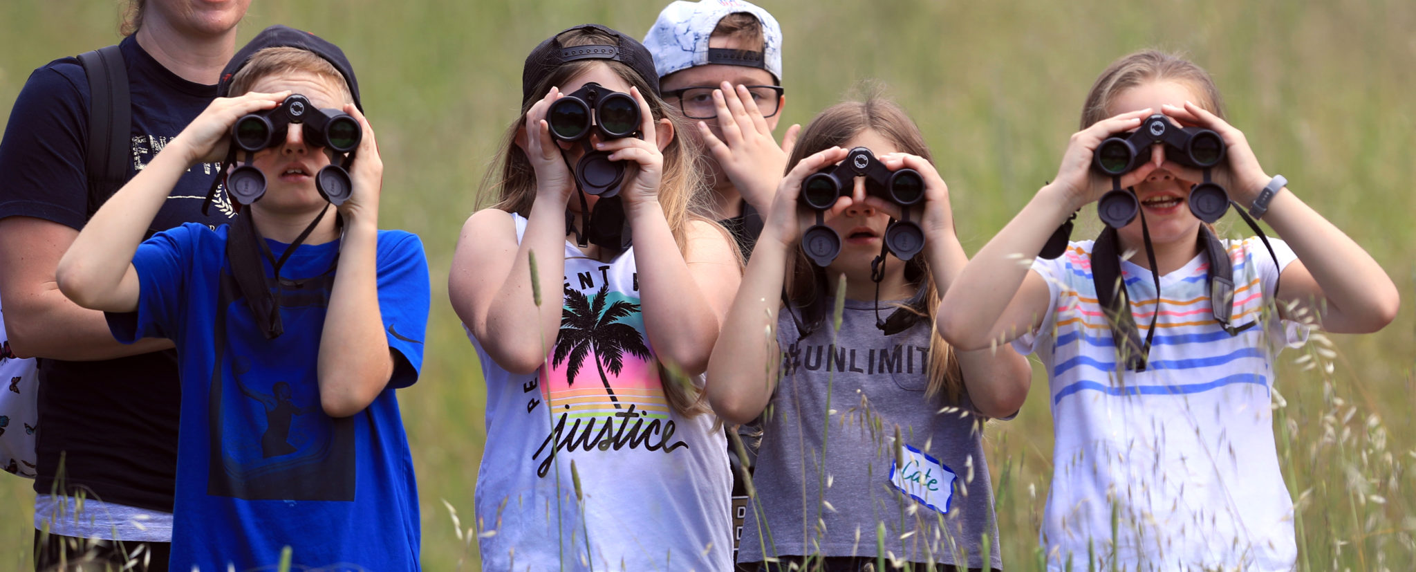
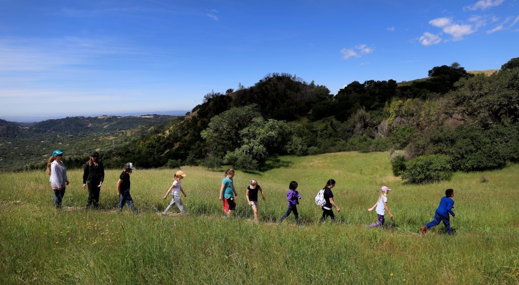
Given that Pepperwood functions as a landscapescale laboratory, it’s only appropriate that education is central to its mission. The property draws large numbers of graduate and post-doctoral researchers from the University of California, but it also hosts students and faculty from a wide range of other educational institutions, including community colleges, high schools, and primary schools. On any typical day at the preserve, it’s not unusual to encounter yellow school buses lumbering up or down the long, serpentine drive that wends from Calistoga Road to the Dwight Center. Weekend hikes and workshops offer inquisitive citizens immersive experiences in a wide range of subjects, including fire ecology and local flora and fauna.
Moreover, Pepperwood is doing its part to cultivate the next generation of conservation scientists through TeenNat, a summer intern program for teenagers. Sponsored in conjunction with Save the Redwoods League, TeenNat teaches kids about the effects of fire on coast redwoods. In its most recent season, 26 interns worked with preserve ecologist Michelle Halbur to log the impacts of the Tubbs fire on Pepperwood’s redwoods, including the heights the flames reached on the trunks and the number and vigor of new shoots sprouting from the bases of the scorched trees. Subsequent classes of interns will continue these studies, tracking the recovery of the individual trees over time. Groups of interns are also studying wildlife at the preserve. Along with fairly common “glamour” species such as mountain lion and black bear, some animals rarely seen in this portion of the Coast Range have been documented post-fire, including porcupine.
“And there were some recent badger sightings,” says Comendant. “That’s a huge event for us. Very few have been seen on this [the east] side of Highway 101. They were almost completely eliminated from this area due to development and eradication efforts by ranchers, so we’re incredibly excited to have them here again.”
As the school year drew to a close, students were touring the Dwight Center gallery, where a remarkable collection of Pomo and Wappo handicraft has been on display. Curated by Ben Benson, Pepperwood’s cultural resources coordinator, the exhibit consists of native basketry in a wide range of sizes and configurations.
Some baskets were used for storing acorns, the literal staff of life for California native tribes. Others seem appropriate for maize, the native grass seed gathered assiduously each summer and fall and used, like acorns, for porridge or gruel. Some of the baskets are small, almost decorative, and could have functioned as reliquaries for sacred objects. All combine utility and high aesthetics, reflecting the conflation of practicality and art in the daily life of the North Coast tribes. Many have abalone shell or woodpecker scalp feathers interwoven through the coils.
They are all, in short, unimpeachably beautiful. But this isn’t simply an exhibit of sophisticated basketry. The objects emphasize the millennia-long habitancy of the North Coast by indigenous peoples. Native people were integral to Pepperwood, part and parcel of its ecological fabric. As did most California tribes, the Pomo and Wappo periodically burned the land to encourage acorn-producing oaks over conifers and seed-rich grasslands over chaparral; periodic burning also created mosaic patterns in the woodlands, diversifying wildlife species and improving hunting access. Native knowledge and wisdom is still manifest at Pepperwood today, observes Micheli. The preserve’s prescribed fire programs are designed to produce the same results — healthy oak savannas and grasslands, abundant wildlife and a fire-resilient landscape — that characterized native seasonal burning efforts for thousands of years.
“We’re also fortunate to work with a Native Advisory Council,” says Micheli. “The members help us protect indigenous artifacts and cultural resources, and they contribute deep ecological insight that helps guide our adaptive management programs.”
The council also ensures that Pepperwood remains accessible for local native communities. Cultural and religious celebrations are held regularly at the preserve, and tribal members make periodic use of traditional resources, such as California bay laurel (aka pepperwood) nuts.
Other spectacular nature preserves exist along the North Coast, but Pepperwood stands out not just for the quality of its habitat but for the depth of the research it supports. In a very real sense, Pepperwood exists as both a natural system and vast store of knowledge with key lessons for the present and future.
That role has huge implications for the North Coast as we move deeper into an epoch characterized in ever greater ways by the impacts of human activity. At Pepperwood, the effects of the shifting climate are being assiduously tracked, and interventions — for saving wildlands and wildlife, property, and human lives — are under development.
“We know things are changing,” says Comendant, “and as we monitor and analyze those changes, we’re figuring out responses that will help protect both our landscapes and communities. We’re deeply interested in pure science — but there are also urgently needed and practical applications growing out of our research.”