


Written by Diane Peterson for The Press Democrat.
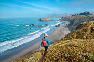
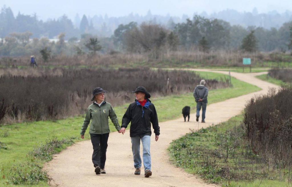
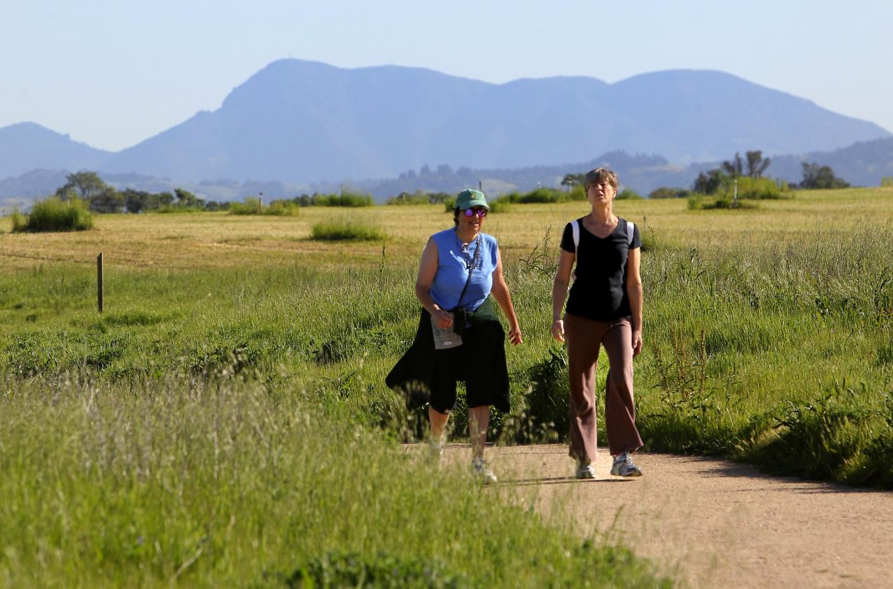
The Laguna de Santa Rosa Trail is a popular destination for dog lovers such as Genevieve Jago of Sebastopol, who hooked up her energetic, 8-month-old English Cocker Spaniel in the Highway 12 parking lot and embarked on a restorative walk on a warm, spring day in early April.
“My brother and I come here a lot,” Jago said. “We bring our dogs and go on runs.”
With just a slight elevation of 50 feet, the multi-use trail stretching from Highway 12 to Occidental Road is also ideal for older hikers who may not have the strength or agility to tackle more strenuous climbs. There are several benches located at Kelly Pond near Occidental Road, where you can rest and enjoy the view over the Santa Rosa Plain.
The location of the trail just outside downtown Sebastopol makes it ideal for a meet-up with friends, who may want to linger afterwards for a cup of coffee and a pastry at one of the Barlow’s coffee shops, such as Village Bakery or Taylor Maid Farms.
The trail, which opened late in 2012, gives folks a chance to explore and learn more about the Laguna de Santa Rosa, a 14-mile long wetland complex that drains into a 254-square mile watershed. Every drop of water falling into the watershed flows into the Laguna, then into Mark West Creek, the Russian River and eventually, into the Pacific Ocean.
The trail crosses Kelly Farm, a 397-acre property purchased in 1979 by the City of Santa Rosa for its recycled water program. The farm now offers unfarmed, natural areas to promote native biodiversity and is bisected by Duer Creek, which runs between Kelly Pond and Kelly Marsh.
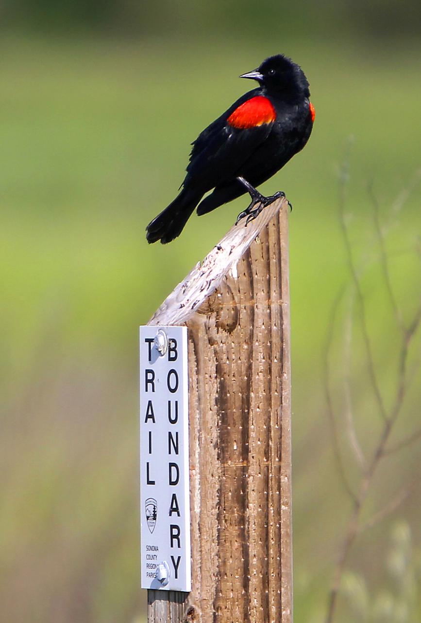
Besides serving as a significant floodplain during the winter, the Laguna also provides one of the richest and most biologically diverse areas of wildlife habitat in Sonoma County, with more than 200 species of birds, including bald and golden eagles, osprey and hawks in addition to river otters, bobcats and gray fox.
The coast Miwok and Southern Pomo lived in this fertile watershed for tens of thousands of years before the European settlers, hunting game and harvesting plants for food, clothing, shelter and boats.
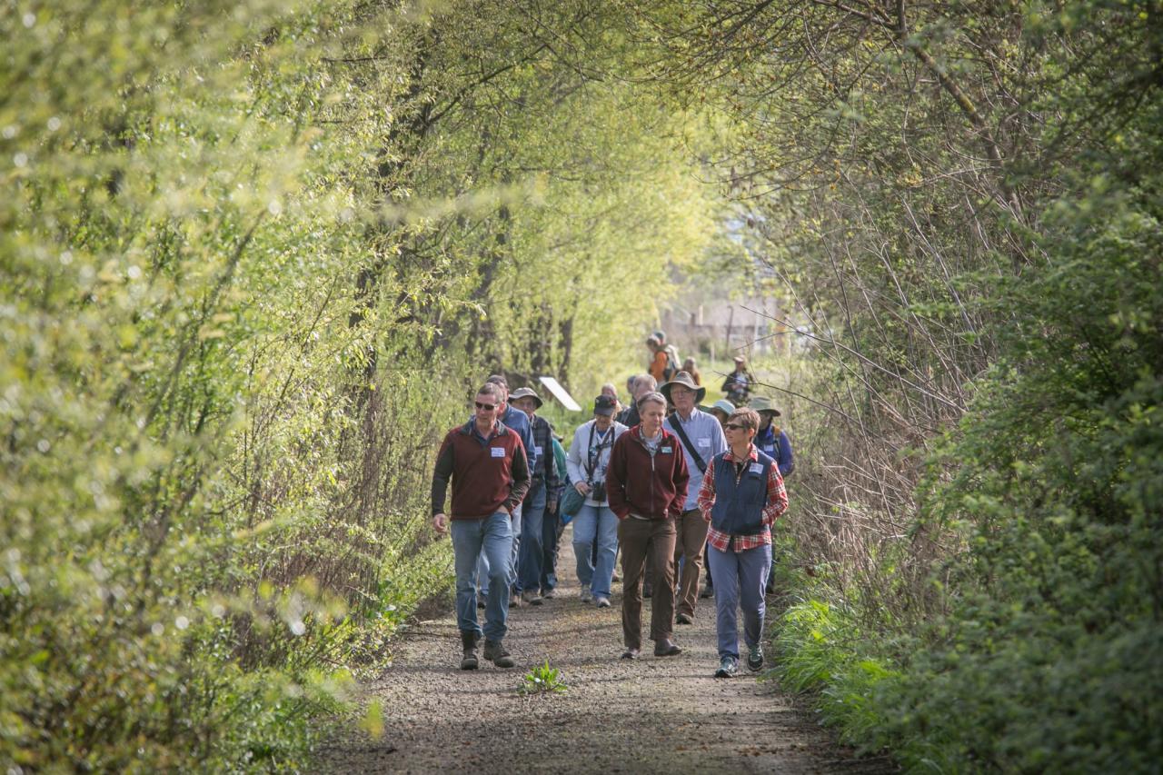
Hikers who leave their four-legged friends at home can get a much closer look at the wildlife here by taking the pedestrian-only loop through the Laguna de Santa Rosa Wetland Preserve on the way back to Highway 12.
The preserve features riparian forest and floodplain, seasonal wetlands and vernal pools, upland valley oak savanna and freshwater tule marsh. During a recent walk along the grassy trail, a cacophony of birdsong rose from the wildflowers fields, blackberry bushes and cattails, where red-winged blackbirds and marsh wrens flitted in and out. Overhead, turkey vultures and egrets soared, tree swallows swooped in formation and a tiny hummingbird alighted gracefully on an oak limb.
In the grasslands, there were plenty of jackrabbits hopping under foot, unperturbed by the presence of humans. Since this is very sensitive habitat, hikers must stay on the trail as it wends its way through Meadowlark Field.
On a warm day, there are lots of shady picnic tables along the trail to stop at for a drink or a bite to eat. A bench under an oak near the southern entrance is engraved with an appropriate verse from Alice Walker: “We have a beautiful mother. Her green lap immense. Her brown embrace eternal. Her blue body everything we know.”
Laguna de Santa Rosa Trail
Hiking distance: 2.4-mile double loop
Hiking time:- 1.5 hours
Configuration: double loop
Elevation gain: 50 feet
Difficulty: easy
Exposure: mostly open meadows
Dogs: allowed
Maps: U.S.G.S. Sebastopol
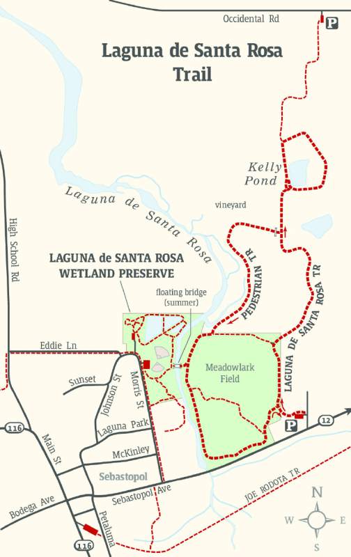
Laguna de Santa Rosa Trail Map
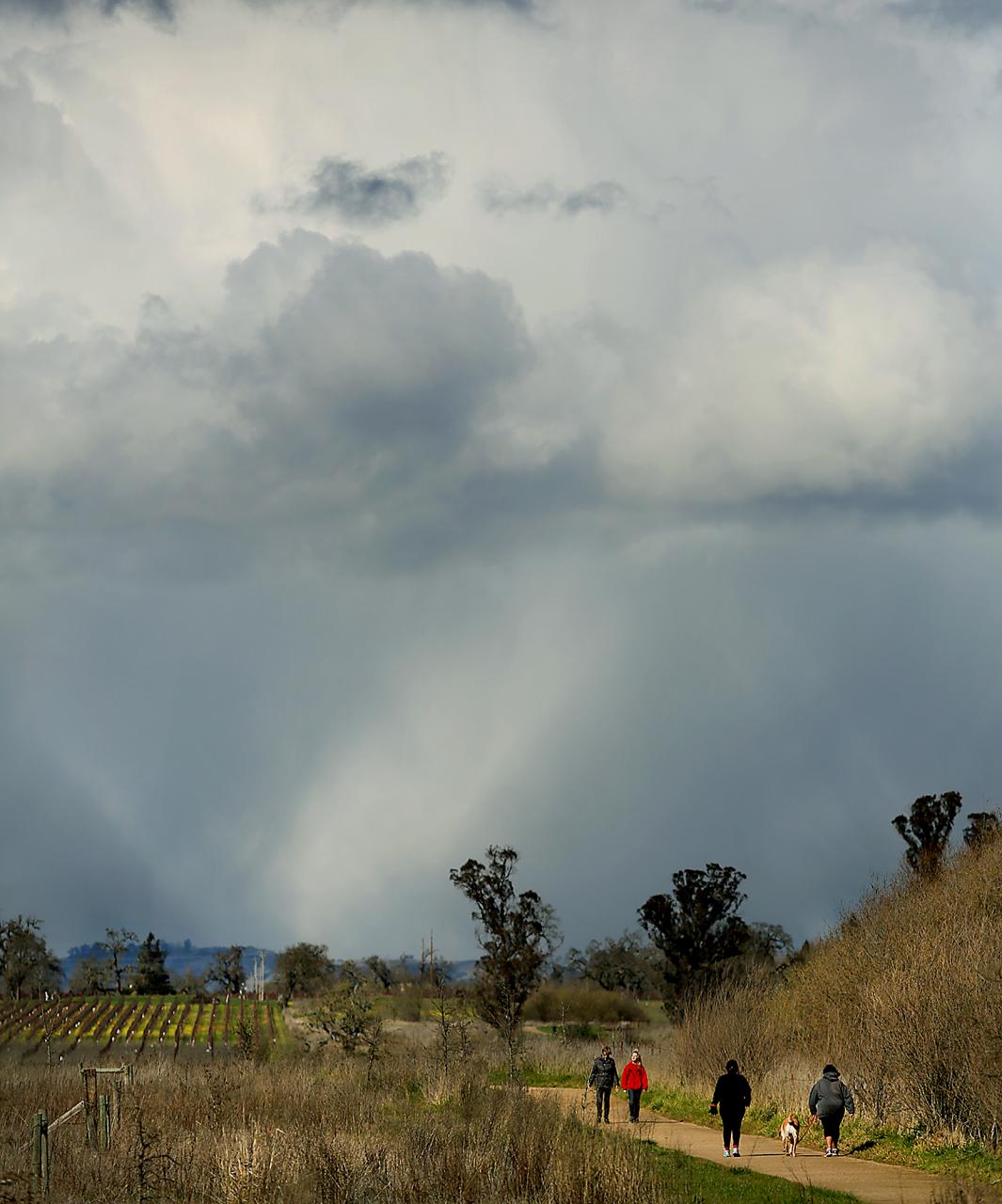
The Laguna de Santa Rosa is Sonoma’s largest freshwater wetland, comprised of a 30,000-acre complex of open waters, verdant wetlands, expansive grasslands, perennial marshes, oak and ash savanna, riparian forest, vernal pools, and ponds. The wetland, extending from Forestville to Cotati, serves as a huge storage pond during heavy rains and is a critical flood basin for the Russian River. The laguna provides a stopover for thousands of native and migrating birds along the Pacific Flyway, with more than 200 species of birds.
The Laguna de Santa Rosa Trail is a multi-use hiking, biking, and equestrian trail that winds along the east side of the water-way’s main channel. A 1.8-mile trail connects Highway 12 in Sebastopol with Occidental Road just to the north, with trailheads along each road. The trails opened to the public in 2012.
This hike winds through the Laguna de Santa Rosa Wetland Preserve and the adjacent Kelly Farm along a 2.4-mile double loop. The route travels through mostly open grasslands dotted with oaks, eucalyptus, and blackberry vines. The trail circles Kelly Pond, frequently teeming with birds. There is a bench that offers an overlook of the pond and a distant view of Mount Saint Helena. A -pedestrian-only path drops into the floodplain and parallels the Laguna waterway in lush riparian forest.
___
To the trailhead
Hwy 12 • Sebastopol
38.405262, -122.811029
The Highway 12 (southern trailhead) is located along the eastern edge of Sebastopol.
From Sebastopol Road (Highway 12) and Main Street in downtown Sebastopol, drive 0.7 miles east on Sebastopol Road to the signed Laguna de Santa Rosa Trail turnoff on the left. It is located just east of the Chevron gas station. Turn left, then another quick left into the parking lot. A parking fee is not required.
From Santa Rosa, drive 5.5 miles west on Highway 12 to the posted trailhead turnoff on the right.
The northern trailhead is located at 5420 Occidental Road, Santa Rosa.
The hike
From the trailhead kiosk, take the well-defined trail north to a posted junction at 100 yards. The left fork (the return route) leads to the Laguna Wetland Preserve. Begin the loop straight ahead, staying on the Laguna de Santa Rosa Trail. Skirt the east edge of Meadowlark Field to a signed Y-fork at 0.3 miles. Stay to the right and follow the raised path, overlooking the open meadows and a view of Mount Saint Helena. Continue to a gated pedestrian trail on the left at 0.8 miles. To the left is the return route. For now, continue straight along the east side of a vineyard to an overlook with benches at Kelly Pond. A half-mile trail circles the pond, a popular habitat for the birds. Views of the pond extend along the west and south sides. From here, it is 0.6 miles north to the Occidental Road trailhead.
After circling the pond, return 0.2 miles to the pedestrian gate, now on the right. Pass through the gate and head west through the meadow. Curve left and walk south to a T-junction. Bear right and stroll through a mixed riparian forest (predominantly oaks) to a signed junction with the Laguna Wetland Preserve on the right (Hike 65). Walk 35 yards to the right to the banks of the wide creek channel and a summer floating bridge.
Return to the forested main trail and proceed south, parallel to the creek channel. Follow the east banks of the waterway towards Highway 12. Curve left, skirting the south end of the preserve to complete the second loop.
Source: “Day Hikes Around Sonoma County, 2nd Edition” by Robert Stone (Day Hike Books, 2016)